


Introduction
The Geological Ground of Artificial Intelligence
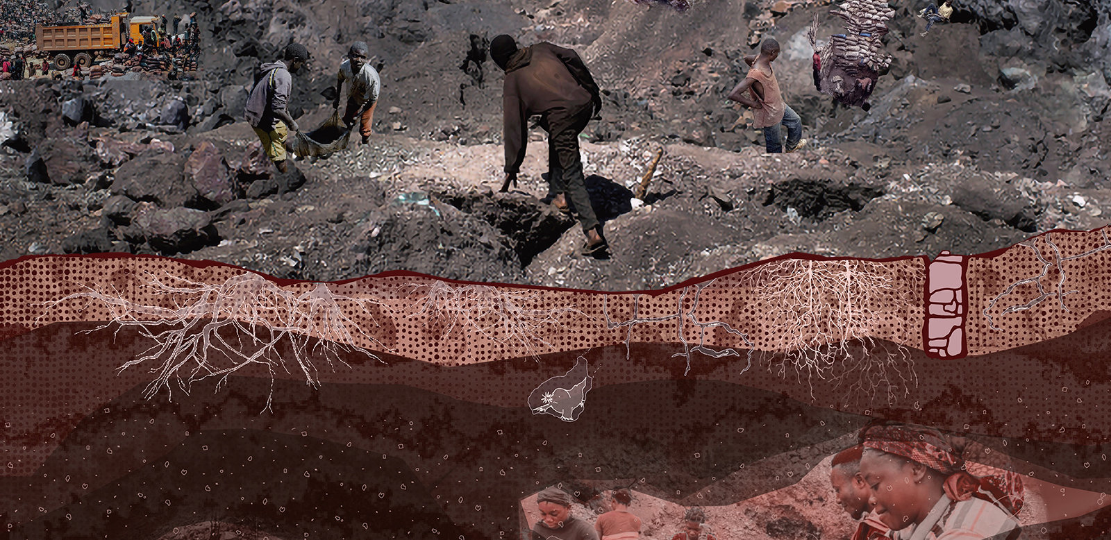
Less than a decade ago, media theorist Jussi Parikka called for a geological understanding of media, arguing that digital technologies cannot be separated from the material systems that sustain them. Digital infrastructures are embedded within layers of minerals, labour, energy, and logistical networks that extend from local environments to planetary scale. What appears as seamless information is supported by vast extractive systems operating along a vertical axis, from deep subsurface mining to buildings, energy grids, data centres, and orbital satellites (Parikka 2015, p. 4).
These infrastructures are not composed of minerals and machines alone; they are produced and maintained through human labour. Mining regions are inhabited environments shaped by long histories of ecological knowledge, survival, and adaptation. Communities living in these territories develop situated understandings of land, materials, and environmental change through everyday bodily encounters with the ground.
Artificial intelligence emerges within this expanding landscape of material infrastructure. Recent advances in artificial intelligence, both in computational methods and specialised hardware, have intensified the entanglement between digital systems and planetary infrastructures. Contemporary AI relies on large neural networks trained on massive datasets, supported by specialised hardware such as graphics processing units (GPUs) and tensor processing units (TPUs). Training and operating these systems requires extraordinary levels of computational power, energy consumption, and mineral resources (Strubell et al. 2020). The digital economy therefore depends on global supply chains of energy and minerals, making the environmental and material impacts of digital infrastructures increasingly visible. Artificial intelligence is therefore a geological and extractive system that reorganises matter and energy at a planetary scale, as much as it is a technological one.
Parikka further emphasises that our relationship with the Earth is mediated through technologies of visualisation such as remote sensing, mapping, measurement, and computation (Parikka 2015, p. 12). These techniques increasingly translate environmental processes, geological formations, and atmospheric systems into datasets that are analysed and modelled computationally.
At the same time, AI contributes to a paradox of visibility. As art critic Kirsty Bell observes, artificial intelligence appears to offer limitless synthetic creativity. Almost any conceivable image can now be produced algorithmically (Bell 2026). Yet this apparent immaterial creativity conceals the extensive infrastructures required to generate such outputs. Visualisation of planetary reality through digital data depends on vast infrastructures that extract energy and minerals from the Earth.
Many environmental and energy strategies rely heavily on metric-based quantification and data-driven optimisation (Mayapple Energy Transition Collective 2026). Since the early 2000s, geoscientific research has undergone significant evolutions. Techniques such as seismic imaging, once used primarily to locate fossil fuels, are now widely applied to identify geothermal resources, hydrogen storage sites, and minerals necessary for batteries and electronic devices (Letcher 2012). These planetary-scale modelling practices for climate change, renewable energy systems, and resource assessment increasingly rely on artificial intelligence, and further expand the computational infrastructures that support them.
As historian Jean-Baptiste Fressoz argues, energy transitions operate less as transformations than as processes of accumulation. New technologies are layered onto existing infrastructures, extending and intensifying extractive regimes rather than replacing them (Fressoz 2024). Contemporary technological infrastructures largely privilege metrics, optimisation, and predictive modelling. The accumulation of data in unprecedented quantities requires further infrastructural expansion, in storage capacity and in the human labour of the data-labelling workforces needed to train these systems. From this perspective, the rise of AI infrastructure, often out of sight from the user, does not necessarily produce a more “intelligent” relationship with the Earth. Instead, it intensifies planetary extraction. Furthermore, these approaches, represented primarily through datasets and simulations, struggle to account for the relational and embodied dimensions of specific geographic contexts.
Throughout this paper, we use geological as an epistemological method rather than a purely material category: a way of reading the infrastructure of AI through the temporal logic of sediment – layered, partial, and built up over time through biological and anthropogenic processes. Thinking geologically shifts attention away from AI as abstract computation towards the infrastructures, histories, and material conditions that sustain it, and towards what we frame as a grounded, situated intelligence.
This framing draws on Donna Haraway's notion of situated knowledge, in which all knowledge is partial, and the pursuit of universal, view-from-nowhere objectivity reduces what knowing can mean (Haraway 1988). Following Haraway, we take the body as the apparatus through which situated knowledge is produced, meaning the planetary can, and perhaps must, be approached at a small, bodily scale rather than only from above. Situated geological intelligence, in this sense, is geographically specific rather than universal: produced through bodies sensing, improvising, and playing with the ground, rather than through the abstract, view-from-nowhere gaze of satellite and remote-sensing data. It privileges the temporal, situated understanding built by communities over standardised, universal metrics.
Situated geological intelligence is therefore partial and not universal knowledge, and this partiality is precisely what equips it to attend to what remains hidden. The sectional approach developed later in this paper cuts through that hiddenness directly, making visible what computation can and cannot register beneath the ground. This is not a call to retreat from computation into some romanticised, pre-technological relationship with the ground. It is a provocation for a more complementary, inclusive approach, one that lets geological forms of intelligence sit alongside metric and computational systems, attending to capacities the latter cannot register: capacities that, we suggest, begin in the voids within and between stones.
This paper develops its argument through an interdisciplinary creative research methodology that combines case studies and theoretical analysis, visual methods such as collage and mapping, and embodied practice such as choreography and movement. These methods aim to reveal relationships between bodies, infrastructures, and geological environments that computational models cannot. The case studies are organised around two geographies that examine AI’s foundational infrastructure: the grid and the land. Beirut’s improvised electrical grids show how communities produce infrastructural knowledge under conditions of unstable energy supply: intelligence as negotiation and maintenance. Lubumbashi’s mining landscapes show how bodies produce geological knowledge through direct engagement with extractive territory: intelligence as adaptation and memory. This proposes a complementary approach to technological systems, arguing for a shift in emphasis:
From infrastructure to the body, our final section, on play as conceptual provocation, questions how power inhabits the body’s relationship to land and labour. We understand play here as an embodied way of engaging with the world, its environments and its people, structured through shared rules and the imaginative reuse of one’s immediate surroundings. Where computation derives rules from data, play derives them from matter. Play, we argue, is a method for connecting the body to the planetary, unsettling productivity and its measurable ends rather than simply escaping them.
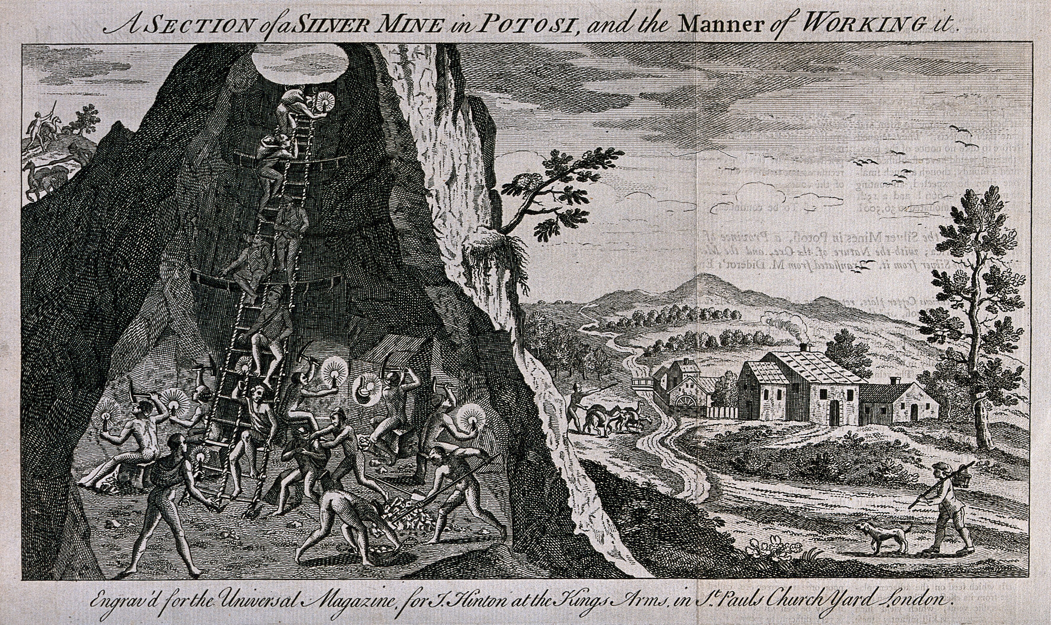
Figure 1: Silver mine, Potosí, Bolivia, c. 1750. A cross-section of body and geology three centuries before the term “infrastructure” existed (Wellcome Collection/unknown author 1750).
Infrastructure: From Foundation to Extraction
All extraction depends on infrastructure; local extraction scales up through it. Roads, pipelines, electrical grids, data centres, and satellite networks form the logistical infrastructure that sustains contemporary technological systems. Artificial intelligence, we argue, is therefore both digital interface and material infrastructure.
The prefix infra refers to what lies beneath, the foundations that allow structures above to function (Merriam-Webster 2026). The term emerged in nineteenth-century France to describe the foundational networks supporting industrial systems such as railways, canals, and electrical grids.
Infrastructure organises collective life. Architectural theorist AnnaLisa Meyboom describes infrastructure as a systemic foundation enabling connectivity and collective activity (Meyboom 2009). In principle, such systems do not necessarily imply extractive relationships.
Industrialisation, however, closely tied infrastructure to efficiency and optimisation. Since the first highways were built in the United States in 1913, the morphologies of roads and highways have been engineered using traffic modelling and statistical analysis to reduce congestion and maximise circulation efficiency (Desportes 1991; Lay 2012). Infrastructure became inseparable from complex metric systems designed to regulate flows.
Digital infrastructures further push the flow of energy and material. Data circulation depends on carefully calibrated environments, including mineral supply chains for semiconductor fabrication, cooling systems for data centres, high-voltage electrical grids, and orbital communication satellites. Behind every promise of efficiency lies a deeper extraction that the user rarely perceives.
Yet infrastructures are never purely technical, and extraction is never purely material. As anthropologist Gretchen Bakke observes, the grid also organises social life, labour relations, and political power; grids should be understood as technological, economic, legal, meteorological, and cultural systems. In this sense, the grid can be extractive, shaping collective trauma, or constructive, shaping collective hope. Nikola Tesla argued that electrical systems are structures that transform collective imagination (Bakke 2016, pp. 271, 289). Our research asks whether AI actually makes a better grid, a better infrastructure, or simply a more efficient one. That question turns attention to what is already there:
Improvised Infrastructures: Counter-Grids over Smart Grids
Contemporary energy discourse often celebrates smart grids. Enhanced with artificial intelligence, smart grids promise greater energy efficiency, resilience, and reduced environmental impact (IEA n.d.).
Grids also operate as complex socio-technical machines, managed by utilities, governments, and market actors that translate electricity flows into data, forecasts, and monetary value. While contemporary discourse frames smart grids as technologically sophisticated systems capable of optimising energy distribution, Bakke reminds us that even centralised electrical infrastructures are never fully predictable or controllable (Bakke 2016, pp. 24, 139, 141).
In many parts of the world, especially the Global South, infrastructures operate through improvisation as part of everyday life. In regions affected by chronic infrastructural neglect, electrical grids frequently suffer from outages, lack of maintenance, overloaded capacity, and underinvestment. Residents often rely on informal operators who provide electricity through private generators or improvised networks. Access to power becomes expensive, inconsistent, and sometimes dangerous.
Lebanon offers a striking example of how infrastructure is transformed by histories of conflict, geopolitical fragmentation and chronic underinvestment. Decades of civil war, repeated Israeli attacks on infrastructure, and the ongoing failure of state electricity provision have led residents to develop informal electrical systems, including shared generators, improvised wiring, and neighbourhood power networks. What may initially appear chaotic, instead reveals complex systems of local coordination, maintenance, and negotiation. These forms of improvisation reveal alternative forms of infrastructural intelligence that are situated, collective, and adaptive, emerging from the everyday practices of communities who must constantly negotiate unstable systems.
The tangled electrical cable grid visible in the Burj el-Barajneh refugee camp in Beirut illustrates this infrastructural condition. Residents rely on improvised networks of low-hanging wires that connect buildings through dense webs of electrical lines. This is not an argument for romanticising informality: these same cables pose constant risks of electrocution and fire, and have caused numerous deaths and injuries over the years. These networks are material expressions of political histories, displacement, and collective adaptation.
These conditions stand in stark contrast to the infrastructures that support contemporary artificial intelligence. AI development relies on highly controlled, resource-intensive environments, including hyperscale data centres, semiconductor fabrication facilities, and specialised computing clusters. These infrastructures require stable electricity supplies, continuous flows of water for cooling, and vast quantities of critical minerals.
This contrast reveals a broader infrastructural asymmetry. Digital infrastructures that support artificial intelligence concentrate resources, energy, and computational capacity within a relatively small number of corporate and geographic centres. Large technology companies increasingly control access to computational resources, shaping the direction of AI development according to market priorities. Meanwhile, populations in regions affected by extraction, infrastructural neglect, or political instability experience digital infrastructure through conditions produced by this technological, political, and economic asymmetry. This asymmetry is also geological and historical. As geologist Kathryn Yusoff argues in A Billion Black Anthropocenes or None, dominant Anthropocene narratives mask the unequal geographies of extraction that shape the lived experiences of marginalised communities (Yusoff 2018).
In our visual research, these electrical entanglements are traced and reconstructed through collage and stitched drawings. The chaotic cable networks are juxtaposed with images of semiconductor circuits and data centre wiring. These collages operate as analytical tools. By tracing similarities between refugee electrical networks and semiconductor circuitry, they reveal unexpected continuities between infrastructures usually understood as entirely separate.
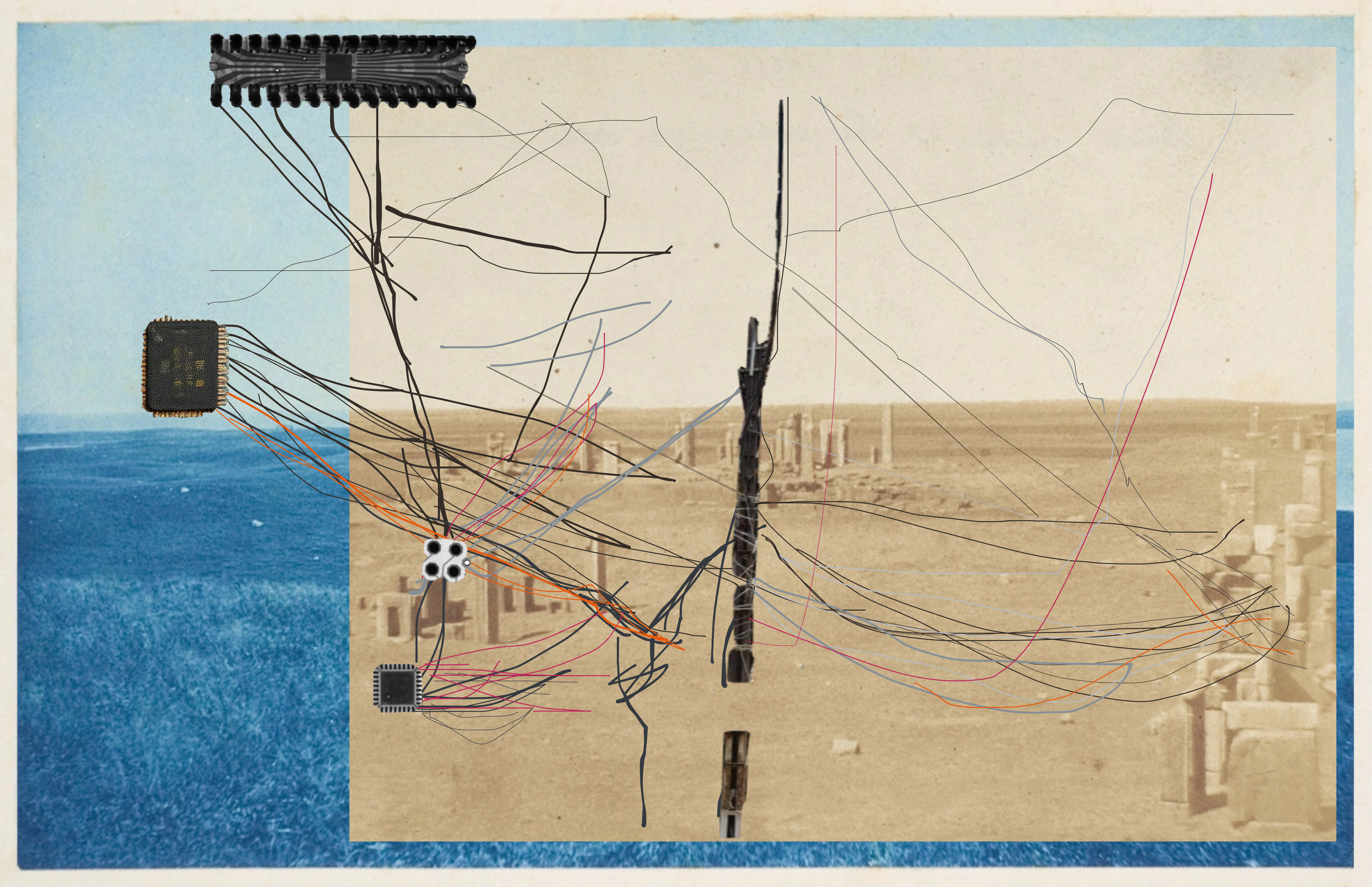
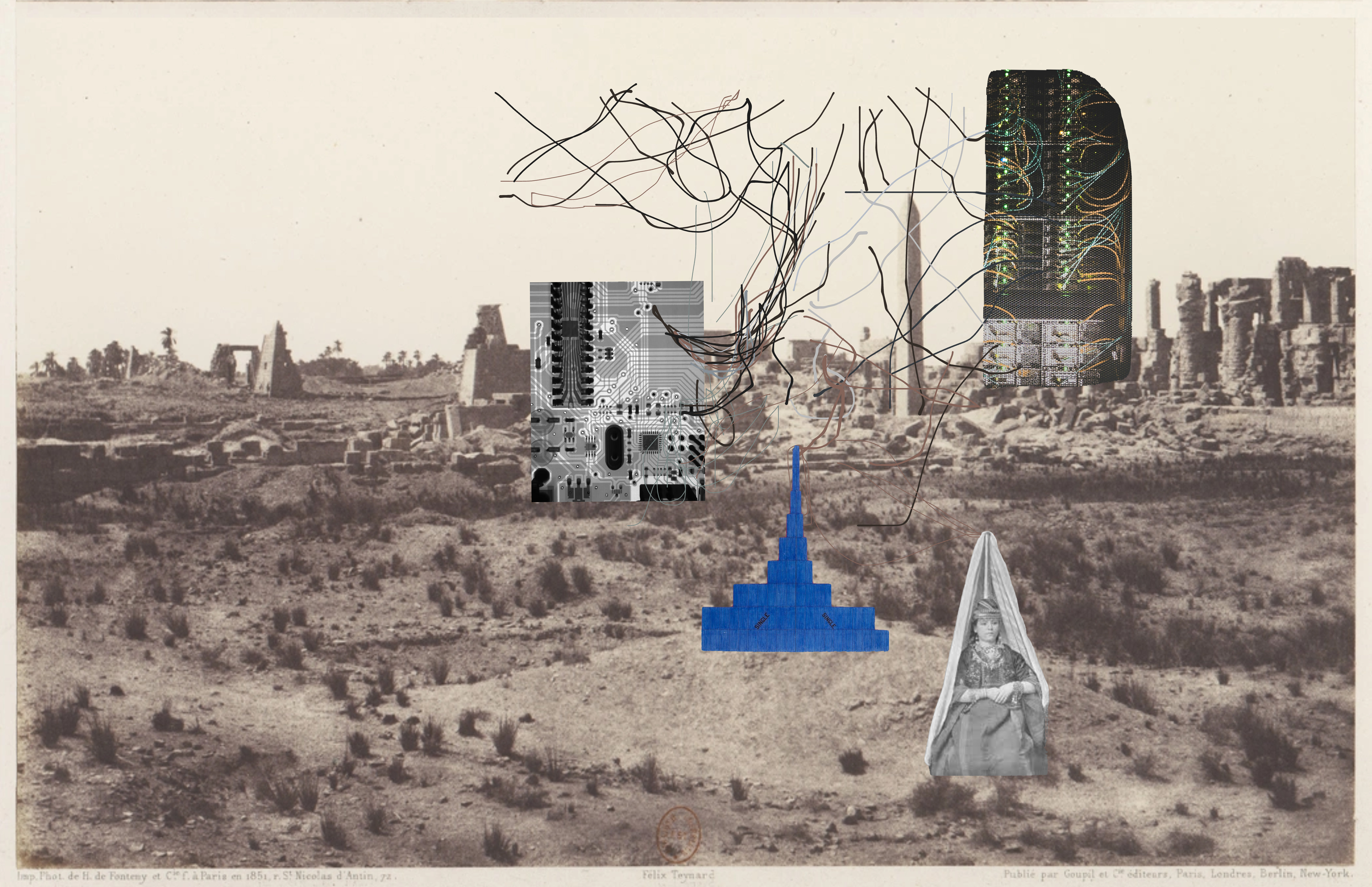
Figures 2a and 2b: Collage tracing the chaotic tangle of electrical cables found in the Burj el-Barajneh refugee camp in Beirut (Tegho 2025).
Over fifteen years ago, landscape architecture scholar Pierre Bélanger proposed a related perspective with his concept of landscape infrastructure. Bélanger describes these processes as performative and reciprocal, evolving through continuous interaction rather than predetermined design outcomes (Bélanger 2009).
From this perspective, these evolving infrastructures in Lebanon can be understood as forms of counter-infrastructure that evolve through everyday practices of maintenance, negotiation, and adaptation with the ground and the society they serve.
Through this kind of counter-infrastructural approach, communities cultivate trust, shared knowledge, and collective expertise. These grids may not look optimised or profitable at first sight, but they drive long-term, durable transitions that build a larger common benefit. These practices reveal forms of intelligence rarely recognised in conventional technological discourse, and expose the limits of the metric-based optimisation that drives AI infrastructure. Rather than focusing exclusively on optimisation, control, and efficiency, infrastructural design might also learn from practices that prioritise resilience, cooperation, and situated knowledge built from the ground.
Visualising the Planetary Infrastructure: Sectional Approaches
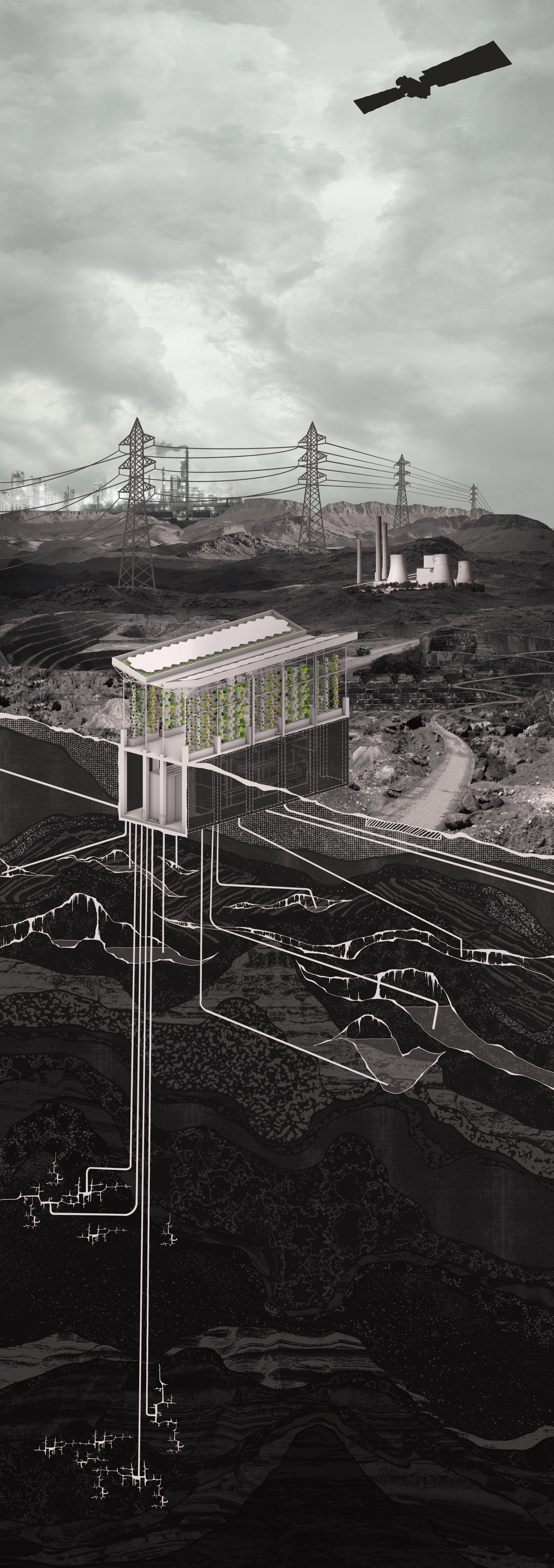
Parikka (2015) argues that visualisation mediates our relationship with the Earth. The infrastructures of AI connect geological formations, energy systems, data networks, and orbital communication technologies. To situate these relationships, this research adopts a sectional approach, examining infrastructure along a vertical axis that extends from subsurface geological layers to atmospheric and orbital systems. The infrastructures discussed so far are sometimes invisible, even from above, beyond the reach of satellite imagery.
Geological sciences have long relied on sectional representations to visualise underground environments in the search for mineral deposits. Techniques such as seismic imaging and subsurface modelling allow scientists to access territories that cannot be physically reached.
These visualisations do more than represent the subsurface. They transform geological territories into measurable, extractable datasets that can be integrated into economic and technological systems. Visualisation thus participates directly in processes of extraction. We therefore use the section as an investigative form of representation, one that asks how, for whom, and for what purposes such infrastructures are visualised.
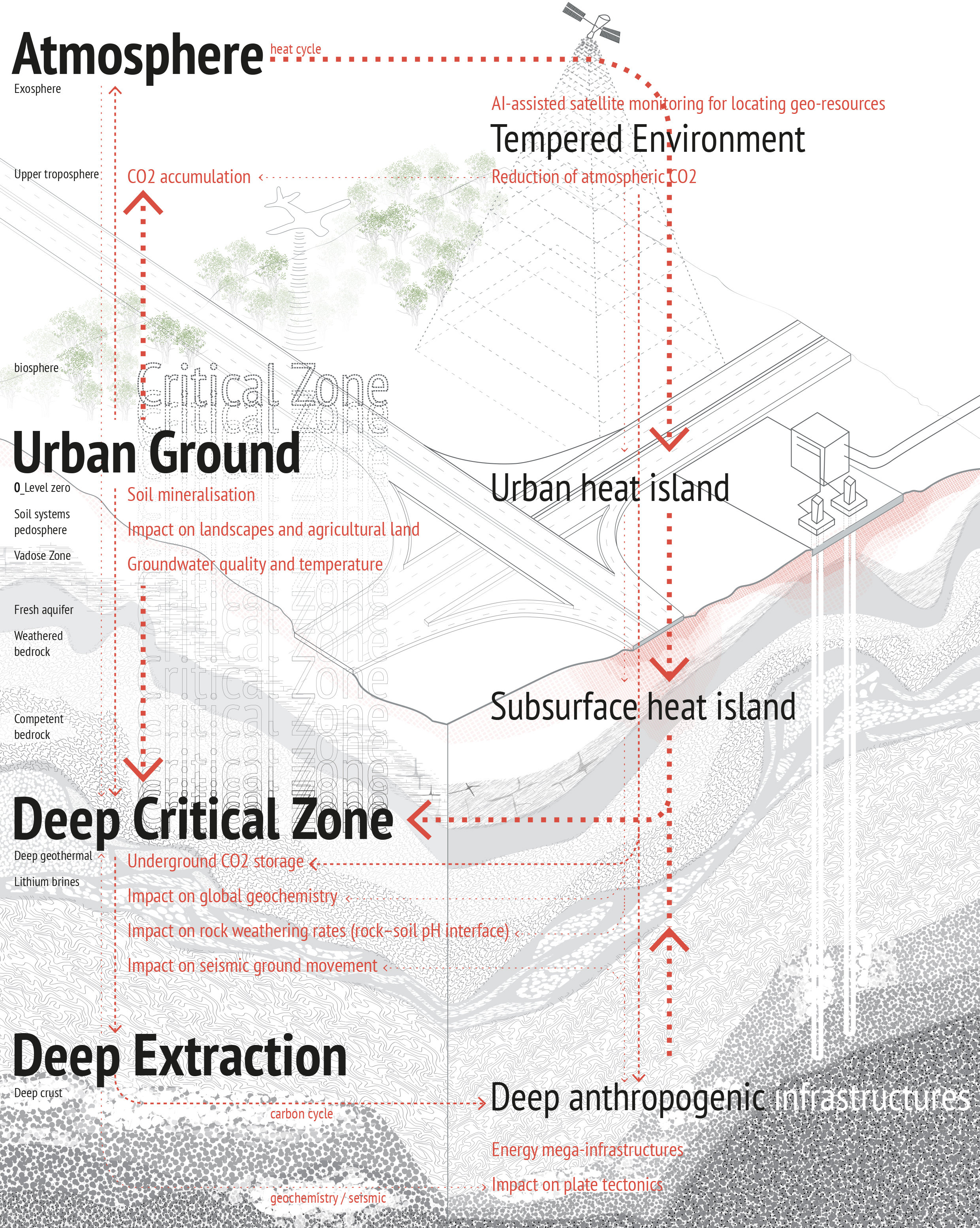
Figure 3: Diagram on the sectional approach (Source: Lee 2026).
Extraction today spans both the material and the immaterial: contemporary digital infrastructure extracts data as readily as it extracts minerals. Geoscientists collaborate with post-petroleum energy companies seeking alternatives to fossil fuels, continuing to collect large datasets on subsurface conditions for locating geothermal energy, hydrogen, and minerals. These datasets exceed human capacity for interpretation, making artificial intelligence essential for processing them. As a result, additional computational infrastructures are required to store, analyse, and manage the data extracted from the ground.
Artificial intelligence thus becomes one of the central instruments through which contemporary science understands the planet. At the same time, the infrastructures that enable these forms of analysis depend on the very mineral extraction and energy consumption they often monitor or seek to mitigate.
As planetary infrastructures expand, their scale increasingly exceeds human perception. Global supply chains, satellite systems, and geological datasets operate across spatial, material, and temporal scales that are difficult to grasp through everyday experience. Contemporary AI infrastructures therefore appear abstract and distant from daily life. This raises an important methodological challenge:
Returning to the sectional perspective, a cut through the planet does not simply describe atmospheric or geological layers. It also opens speculative interpretations of what lies beneath the surface. The underground is not composed solely of stone, minerals, or oil; it has historically been imagined as a space inhabited by ghosts and other unknown forces. This interdisciplinary research investigates whether bodily encounters with geological matter, framed through a vertical perspective, can enable engagement with the messy, relational ground where aliens, monsters, and ghosts have historically been imagined to reside. Read this way, the sectional cut is not only a geological method but an apparatus for holding memory, uncertainty, and multiple temporalities.
Lubumbashi: Reading Extraction Through Body or Data?
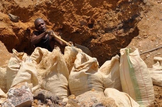
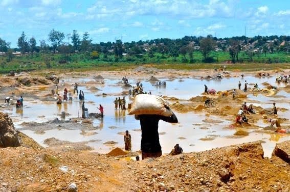
Figures 4a and 4b: Congo Katanga and Goma (Flickr/Bas Van Abel 2022).
One way to address the methodological question raised in the previous section is to examine what remains outside computational data: the extractive landscape as it is lived and carried in the body.
The Democratic Republic of the Congo contains some of the most significant reserves of critical minerals in the world. The country produces approximately 74 percent of global cobalt and more than half of global tantalum production (USGS 2026). These minerals are essential for batteries, electronic devices, and renewable energy infrastructures. Lubumbashi, located in the Katanga mining region, is at the centre of the global race for so-called green minerals (Finn et al. 2025).
The city has been shaped by extraction for more than a century. Colonial mining infrastructure structured its urban morphology and spatial organisation (Voelcker 2023). The legacy of colonial spatial segregation remains visible today, with privileged communities residing in the city centre while mining labour camps were located closer to rural extraction sites outside the city (Finn et al. 2025). Mining infrastructures continue to shape the city’s development, influencing environmental conditions, labour organisation, and everyday spatial practices. The impact of extraction on landscapes is often experienced through the bodies of those who live and work within them.
Artist Sammy Baloji’s work highlights these embodied dimensions of mining landscapes. In Essay on Urban Planning (2013), Baloji documents the colonial regimes imposed on mining workers through archival materials. One account describes how workers were required to kill fifty flies per day in order to receive food rations (National Gallery of Canada 2019). Such histories reveal how extraction shaped not only landscapes but also bodily discipline and labour routines.
Recent research conducted with local displaced mining communities in Lubumbashi further demonstrates the value of community-based perception mapping. Inspired by the urban theorist Kevin Lynch, these studies examine extractive territories through mental mapping of lived experiences (N’tambwe Nghonda et al. 2026). The data showed that this collective, perception-based approach produces a representation of the ground remarkably close to what digital methods can measure, evidence that situated perception can carry real methodological weight.
Choreographies of Extraction: Bodies as Geological Interfaces
In mining environments around Lubumbashi, the relationship between body and ground becomes particularly visible. An underground architecture emerges through bodily labour as workers descend into narrow shafts, dig unstable tunnels, and carry heavy mineral loads across uneven terrain. Each gesture is calibrated in response to the density, fractures, and shifting resistance of the earth (Amisi Mwana 2018).
In this context, movement itself functions as a form of intelligence. Gestures operate as analogue algorithms, while bodies act as adaptive infrastructures that constantly adjust to depth, instability, and material resistance.
Baloji’s photographic series Mémoire (2004–2006) further illustrates these relationships. Colonial archival photographs of mine workers are layered onto contemporary images of industrial ruins. The images show workers carrying loads, standing in formation, or labouring under supervision. Through this visual montage, Baloji reclaims the material and embodied histories of mining infrastructures while challenging conventional understandings of the past and present of his home country (Baloji n.d.).
Baloji later extended this work from the still image into live performance. In collaboration with choreographer Faustin Linyekula, the performance Mémoire (2007) took place inside the remains of colonial copper mines in Katanga. The performance reactivates that history in a moving body: gestures staged inside the abandoned infrastructure itself confront the often-unspoken histories of displacement, labour exploitation, and environmental transformation associated with mining in the Congo (LACMA 2025). Here the body and movement become a way of holding historical weight.
These works suggest another understanding of intelligence. Bodies become geological interfaces through which knowledge of the ground emerges. This understanding develops through continuous negotiation and interaction with geological matter rather than through computational optimisation.
Historically, similar relationships existed in early drilling technologies. Ancient drilling practices in Zhejiang province in China relied on coordinated bodily rhythms using bamboo tools and water pressure (Kuhn 2004). Collective bodily movements functioned as a learning apparatus for understanding the geological properties of the land.
These practices illustrate a form of geological knowledge grounded in embodied engagement. They raise important questions for the governance of extractive territories. Should decision-making rely solely on computational intelligence, or might the embodied knowledge of local communities also inform how extraction is understood and governed? While industrial extraction depends on technologies and data analysis to produce regulatory frameworks, artisanal mining communities cultivate forms of situated intelligence through sustained interaction with geological materials. Rather than opposing metric and technocentric approaches, these embodied practices reveal complementary forms of knowledge, and enrich decision-making in extractive landscapes.
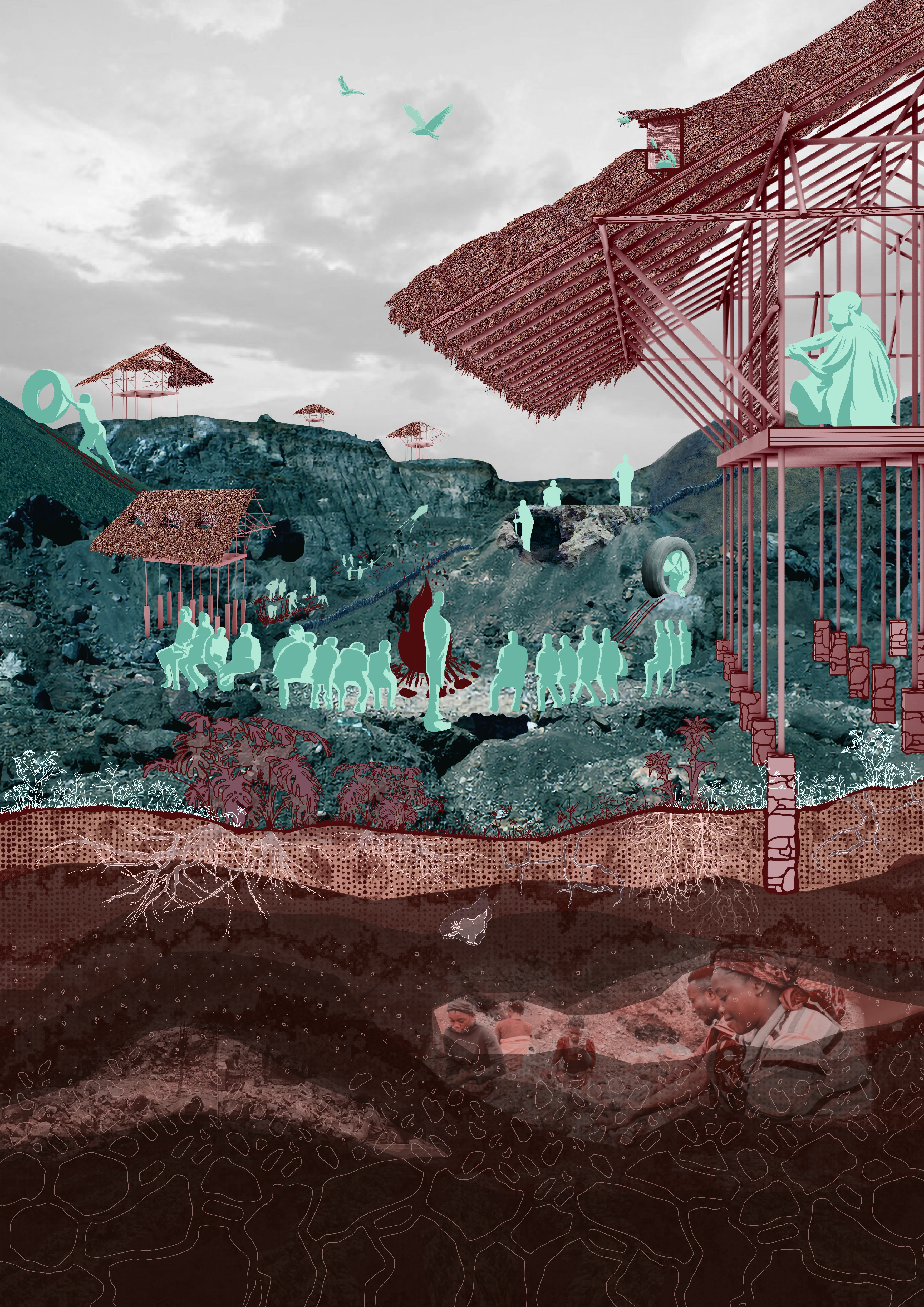
Negotiating Infrastructure: Bodily Intelligence in Extractive Territories
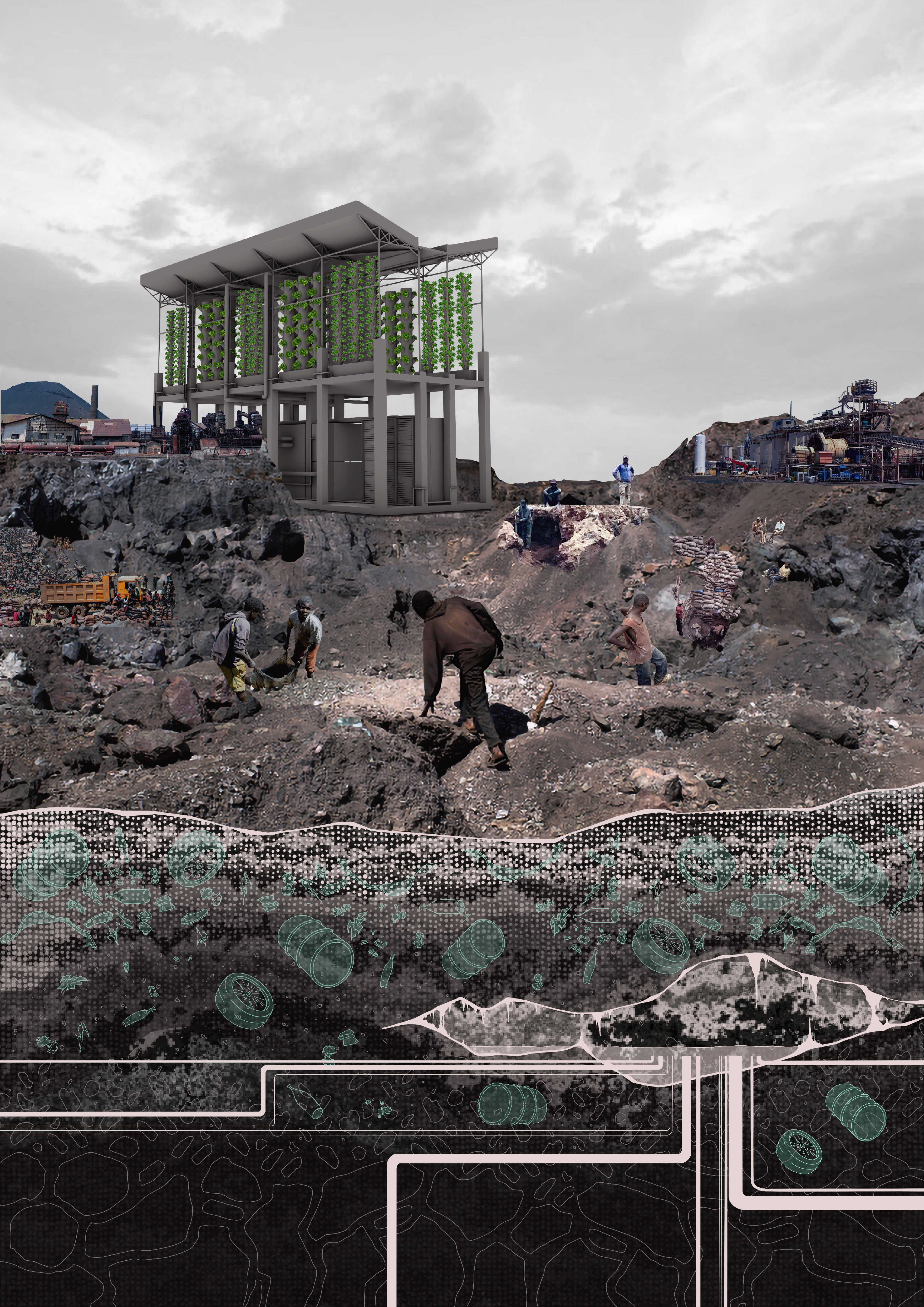
Close bodily engagement with the ground in unregulated artisanal and small-scale mining exposes workers to significant risks, including toxic materials, unstable tunnels, and dangerous working conditions. These risks are often invoked by states and corporations to justify formalising, or replacing, artisanal and small-scale mining (ASM) with the infrastructures of large-scale industrial mining (LSM).
Recent geopolitical developments have further complicated this landscape. With rising global demand for green minerals, the 2025 mineral agreement between the United States and the Democratic Republic of the Congo encourages the formalisation and industrial integration of artisanal mining, to stabilise mineral supply chains (US Department of State 2025).
These top-down formalisation policies further escalate tensions between local communities and the authorities. Corporate actors push the state to expand operations and accelerate profit from mining; when these replacements are executed top-down and at speed, they sometimes produce violent evictions that take no account of local communities’ views. Some local communities prefer their own practices, their own community rules, and the informality that emerges from social practice over generations (Geenen, 2012). The data used to guide formalisation policy come overwhelmingly from mining corporations themselves, and are oriented towards profit. Health impacts on miners, and the reasons communities resist formalisation, remain comparatively undocumented (Balyaminu et al., 2026).
The question is therefore not only how artisanal mining should be formalised, but what forms of knowledge should inform that process. From this perspective, infrastructures might be designed around the knowledge communities already hold, rather than imposed upon them.
From this perspective, the body carries history in ways datasets do not. A miner’s gait, shaped by years of negotiating the geology of narrow shafts, fractures, and shifting rock, holds the physical memory of colonial-era labour routines even where no written record does. Baloji’s works, discussed above, illustrate exactly this: a body trained under one labour regime keeps carrying that training forward, so that trauma and violence are not only archived but rehearsed, in gesture and posture.
This is not an argument for staying informal. In Lubumbashi, as elsewhere, a more inclusive transition can also improve the working health and safety of ASM communities. But as Siegel and Veiga argue, formalisation is a process, not a product delivered by licence (2009). Infrastructures and communities are not opposing systems; they negotiate coexistence through dialogue, care, and shared responsibility.
In this sense, counter-infrastructures become responsive frameworks that give local bodies of knowledge a voice, rather than metric-driven infrastructures. We argue that bodily intelligence can function as a complementary research tool, capable of engaging local communities in transforming extractive territories.
Play as Counter-Infrastructure
In extractive landscapes such as Lubumbashi, open-pit mines remain highly visible within the surrounding areas. Since the late twentieth century, the environmental consequences of large-scale mining have shaped public perceptions of extraction: land degradation, atmospheric pollution, and long-term ecological transformation are now inseparable from how open pits are seen (European Environmental Bureau 2001). Within this context, the open-pit mine has become a powerful visual symbol of socio-environmental exploitation and trauma.
As discussed previously, geological intelligence emerges through bodily engagement with grid and ground. This closing section turns to play as another form of that same intelligence, one that we offer here as a conceptual provocation. We argue that play is a process-based flow without a predefined objective, one that allows a responsive, situated engagement with material conditions that data-driven approaches structurally overlook.
Artist Francis Alÿs explored this possibility in When Faith Moves Mountains (2002), a work in which five hundred volunteers used shovels to shift a sand dune outside Lima by approximately ten centimetres. This collective action had no defined objective; it produced instead a continuous flow of wonder, a playful synchronisation between bodily movement and the ground, the same terrain capable of demanding exhausting physical work shown to also invite improvisation and invention outside the logic of productivity. This collective act of five hundred bodies moving together towards no measurable end was coordinated without top-down hierarchy, synchronised and negotiated among participants. In this sense, the collective play demonstrated in the work is a form of counter-infrastructure, an evolving, adaptive coordination at scale.
A similar dynamic appears in La Roue (2002). In one scene, a child rolls a tyre uphill before climbing inside and descending the artificial hill formed from mining waste. The hill itself is a residue of extraction and exploitation. Yet the child transforms this landscape through the act of play. Here, the ground becomes a terrain to be engaged through improvisation and curiosity, rather than a resource to be dominated (Claes 2023).
These scenes reveal how play can emerge alongside labour in extractive landscapes, functioning as a situated method of thinking with geological material. In La Roue, the trajectory of the tyre is determined by the local heterogeneity of the ground, so play becomes responsive to the specificity of the terrain. The ground’s geological history, sedimented over time, offers rich and particular material constraints, conditions that shape movement and generate new possibilities for engaging the body with the ground. Playing with the ground can thus be a manifesto of situated intelligence: while extractive systems are organised around optimisation and efficiency, play embraces unpredictability, failure, and collective negotiation, resisting predefined outcomes in favour of open experimentation.
Building on this logic, we propose movement scores as a form of play. Stones are imagined as active collaborators, curating relationships between bodies and geological materials (Figure 6). Rather than following a predetermined sequence, the stones’ properties, such as weight and texture, could define rules of movement. This process of play invites constant negotiations between matter and body.
We offer this not as a result but as a provocation: a way of asking what forms of knowledge such an exercise might surface, and what a research method built entirely around letting matter set the terms of movement could look like in practice. In extractive zones, we suggest, play could also open a form of care where care is structurally denied; children playing near mines already invent rules from the same debris and terrain that shapes labour. Extractive landscapes, in this sense, have the potential to become spaces of collective improvisation. As with Alÿs’s dune, collective play can itself become counter-infrastructure, and our proposed movement scores are one way of taking that improvisation seriously as a form of geological intelligence.
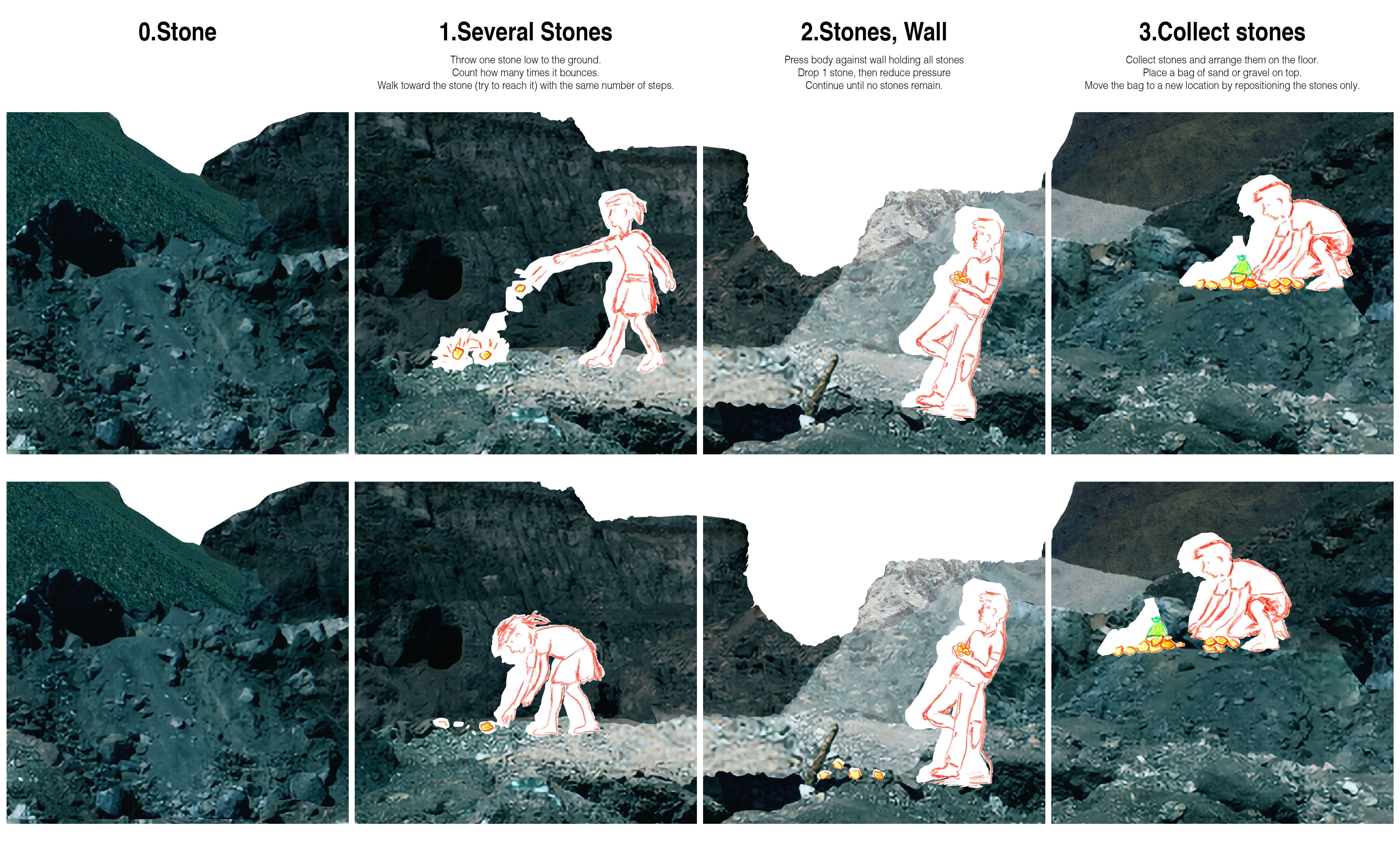
Figure 6: Play scores: weight, texture, and resistance shaping spatial movement with stone (Lee and Tegho 2026)
Designing Infrastructure with Situated Geological Intelligence
The practices explored throughout this research, from improvised infrastructures to bodily engagement and play, offer cumulative evidence for how geological intelligence operates: as negotiation under conditions of scarcity, as memory under conditions of extraction, as improvisation once labour’s constraints loosen into play. This intelligence now turns to what it implies for infrastructural design and governance.
This is not an argument for the primacy of embodied knowledge over computational systems. It is a call for more inclusive infrastructure design in the age of the Anthropocene, capable of holding data-driven governance and local knowledge together. This kind of partial-evidence approach is also gaining credibility within scientific research itself. As the Lubumbashi mapping research discussed earlier suggests (N’tambwe Nghonda et al. 2026), such convergence is particularly valuable in contexts where environmental or infrastructural transitions require the cooperation of local communities. Community-driven initiatives such as the Molokai Clean Energy Hui in Hawaiʻi, for instance, involve residents directly in energy system design and tend to produce more durable, locally accepted outcomes, though they also unfold more slowly than centralised implementation (Mayapple Energy Transition Collective 2026). These examples cannot be copy-pasted elsewhere without reckoning with each site’s specificity, nor read as a template for accelerating current infrastructural development. They are, instead, a case for accepting that slowness is more valuable than efficiency during transition processes, allowing greater inclusion of situated geological intelligence.
Infrastructure, from this perspective, functions as a socio-ecological system as much as a technical one. As Sammy Baloji describes, communities operate through relationships of reciprocity and shared responsibility, networks of individuals who voluntarily engage in exchanges grounded in respect and equity, renegotiated through verbal communication, bodily interaction, and the material traces embedded in objects and places (Voelcker 2023). Recognising this allows infrastructure to incorporate knowledge already present within the communities it runs through, as with the ASM-LSM tension in Lubumbashi described earlier, where the community rules that already define informal artisanal mining could form the basis of a more inclusive approach to formalisation.
The grid and the land, the two cases this paper has traced, are not opposing sites of intelligence but complementary ones. Planetary infrastructures will only be well governed to the extent that they can hold both forms of intelligence, computational and geological, together.
Conclusion
Learning from the Ground
The infrastructure of artificial intelligence is thus deeply material at a planetary scale. Computational modelling remains valuable for managing complex systems and large-scale data analysis, but it cannot fully account for the embodied, relational dimensions of extractive landscapes that unfold across multiple scales at once. This infrastructure needs a more relational form of intelligence, which this paper introduces as situated geological intelligence.
Situated geological intelligence emerges through embodied interaction with materials, communities, and landscapes. It repositions digital infrastructure within a broader ecology of knowledge, one where computation coexists with counter-infrastructure rather than replacing it.
Addressing contemporary planetary challenges may require infrastructures that integrate multiple forms of knowledge: technological, territorial, embodied, and collective. Artificial intelligence increasingly shapes how the planet is measured, modelled, and governed. Yet the ground itself continues to instruct human activity through resistance, weight, texture, and movement.
The challenge is therefore not simply to build more powerful computational infrastructures, but to design planetary infrastructures where computation and situated knowledge can operate together. The future of AI depends as much on learning from the ground as it does on learning from data.

Credits
Sources
Amisi Mwana, Y. et al. (2018). ‘L’activité minière au Katanga et la perception de ses impacts à Lubumbashi, Kolwezi, Likasi et Kipushi’, in J. Bogaert, G. Colinet & G. Mahy (eds) Anthropisation des paysages katangais. Liège: Presses Universitaires de Liège, pp. 253–266.
Baloji, S. (n.d.). ‘Sammy Baloji Memory: An african phantom: Between ruins and modernity’, Prix Pictet. Available at: https://prix.pictet.com/cycles/earth/sammy-baloji (Accessed: 7 March 2026).
Bakke, G. (2016). The grid: The fraying wires between Americans and our energy future. New York, NY: Bloomsbury Publishing.
Balyaminu, J.A., Mphambukeli, T.N. & Magande, T. (2026). ‘Artisanal cobalt mining communities in the Democratic Republic of the Congo: Resilience against cannibal capitalism’, Frontiers in Sustainable Cities, 8.
Bell, K. (n.d.). ‘Pierre Huyghe’s “Liminals” at LAS Art Foundation’. Available at: https://www.las-art.foundation (Accessed: 5 March 2026).
Bélanger, P. (2009). Landscape as infrastructure. Madison: University of Wisconsin Press.
Claes, G.-J. & Symons, S. (2023). Francis Alÿs: The nature of the game. Leuven: Leuven University Press.
Desportes, M. & Crews, J. (1991). ‘The history of highway nodes’, FLUX Cahiers scientifiques internationaux Réseaux et Territoires, 5, pp. 21–33.
European Environmental Bureau (2001). The environmental performance of the mining industry and the action necessary to strengthen European legislation in the wake of the Tisza–Danube pollution. Brussels: European Environmental Bureau.
Finn, B.M. & Cobbinah, P.B. (2025). ‘DRC history is repeating itself in Lubumbashi as the world scrambles for minerals to go green’. Available at: https://theconversation.com/drc-history-is-repeating-itself-in-lubumbashi-as-the-world-scrambles-for-minerals-to-go-green-248571 (Accessed: 5 March 2026).
Fressoz, J.-B. (2024). More and more and more: An all-consuming history of energy. London: Allen Lane.
Geenen, S. (2012). ‘A dangerous bet: The challenges of formalizing artisanal mining in the Democratic Republic of Congo’, Resources Policy, 37(3), pp. 322–330.
Haraway, D. (1988). ‘Situated knowledges: The science question in feminism and the privilege of partial perspective’, Feminist Studies, 14(3), pp. 575–599.
IEA (International Energy Agency) (n.d.). ‘Smart grids’. Available at: https://www.iea.org/energy-system/electricity/smart-grids (Accessed: 5 March 2026).
Kuhn, O. (2004). ‘Ancient Chinese drilling’, CSEG Recorder, 29(6).
Lay, M.G. (2012). ‘An historical review of the assessment and management of congestion’, Road & Transport Research: A Journal of Australian and New Zealand Research and Practice, 21(2), pp. 32–45.
LACMA (2025). ‘Artists represent themselves: Sammy Baloji on Mémoire’. Available at: https://unframed.lacma.org/2025/03/10/artists-represent-themselves-sammy-baloji-memoire (Accessed: 5 March 2026).
Letcher, T. et al. (2012). Materials for a sustainable future. Cambridge, UK: Royal Society of Chemistry.
Mayapple Energy Transition Collective (2026). ‘Putting metrics last: A decolonial feminist approach to evaluating energy justice’, Journal of Political Ecology, 33(1), p. 7789.
Merriam-Webster (2026). ‘Infrastructure’. Available at: https://www.merriam-webster.com/dictionary/infrastructure (Accessed: 7 March 2026).
Meyboom, A. (2009). ‘Infrastructure as practice’, Journal of Architectural Education, 62(4), pp. 72–81.
N’tambwe Nghonda, D. et al. (2026). ‘Spatial footprint of anthropogenic activities in the Lubumbashi charcoal production basin (DR Congo): Insights from local community perceptions’, Geographies, 6(1).
National Gallery of Canada (2019). ‘Focus on the collection: Sammy Baloji’. Available at: https://www.gallery.ca/photo-blog/focus-on-the-collection-sammy-baloji (Accessed: 5 March 2026).
Parikka, J. (2015). A geology of media. Minneapolis, MN: University of Minnesota Press.
Siegel, S. & Veiga, M.M. (2009). ‘Artisanal and small-scale mining as an extralegal economy: De Soto and the redefinition of “formalization”’, Resources Policy, 34(1–2), pp. 51–56.
Strubell, E., Ganesh, A. & McCallum, A. (2020). ‘Energy and policy considerations for modern deep learning research’, Proceedings of the AAAI Conference on Artificial Intelligence, 34(9), pp. 13693–13696.
USGS (U.S. Geological Survey) (2026). ‘Mineral commodity summaries 2026’. Available at: https://apps.usgs.gov/critical-minerals/mineral-commodities-2026.html (Accessed: 5 March 2026).
US Department of State (2025). ‘Strategic partnership agreement between the government of the United States of America and the government of the Democratic Republic of the Congo’. Available at: https://www.state.gov/strategic-partnership-agreement-between-the-government-of-the-united-states-of-america-and-the-government-of-the-democratic-republic-of-the-congo (Accessed: 5 March 2026).
Voelcker, B. (2023). ‘Climate, capital, and colonialism: A Congolese perspective’, Journal of Climate Resilience & Climate Justice, 1, pp. 55–65.
Yusoff, K. (2018). A billion black anthropocenes or none. Minneapolis, MN: University of Minnesota Press.