



“Of things invisible to mortal sight” (Milton 1674, p. 24).
Artificial intelligence does not float in the cloud; it is mined. What appears in public discourse as seamless, immaterial and ubiquitous depends on a dense territorial infrastructure that conceals the geological violence of digital systems beneath the language of innovation. Following Kate Crawford’s claim that artificial intelligence is “neither artificial nor intelligent”, this article understands AI as a material and political formation built from natural resources, fuel, labour, infrastructures, logistics and histories of extraction (Crawford 2021, pp. 8–10). Beneath every model, every interface and every automated response lies a chain of extraction that begins far from the screen. In Chile, that chain runs through the salt flats of the north, where lithium has become one of the materials on which contemporary computation—and many of the green promises attached to it—now depends.
To say that the cloud has territory is to reject the fantasy that intelligence can be detached from the earth, since it depends on aquifers, energy systems, mineral supply chains, logistics corridors and territories made available for planetary computation. This material dependence is why “water-intensive data centres, polluting mineral extraction and e-waste dumping are incontrovertibly part of AI’s footprint” (Lehuedé 2025, p. 1761). Recent research on data centres in Chile shows that digital extraction is already entangled with hydrological stress, infrastructural expansion and corporate mitigation narratives that displace environmental burdens onto specific territories (Díaz Bejarano and Valdivia 2026, p. 945).
In the Salar de Atacama, lithium is presented as the white promise of a green future: essential for batteries, renewable transitions and computational continuity. Yet this promise rests on the broader contradiction that “extraction is the material foundation of a zero-carbon world” (Riofrancos 2025, p. 16), as digital infrastructures and green-transition narratives increasingly converge around the harnessing of new resources, tightening the relation between technological futurity and extractive expansion (Brodie 2025, pp. 1064–1066). This paradox is inseparable from a longer colonial history in which the Global South provides the raw conditions for the North’s narratives of progress. The language may now be sustainability, sovereignty or technological transition, but what is named innovation still depends on asymmetrical geographies of depletion.
The global demand for lithium enables low-carbon mobility and technological transition elsewhere while transferring the socio-environmental costs of decarbonisation to Indigenous territories in the Salar de Atacama. In this sense, the promise of green electromobility carries a “colonial shadow”: it depends on brine extraction, water injustice and the partial recognition of Indigenous understandings of the salar as water (Jerez, Garcés and Torres 2021, pp. 8-9).
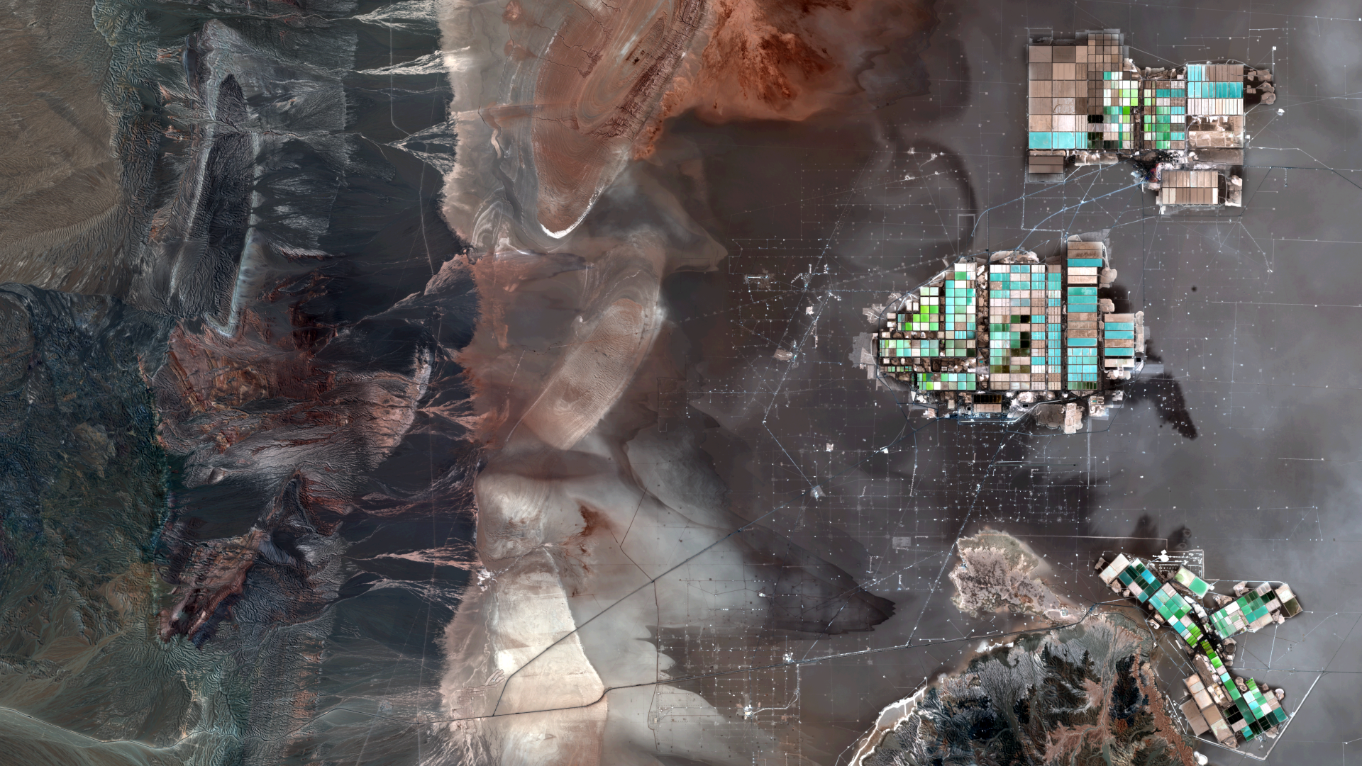
Figure 1: Satellite image of lithium extraction infrastructure in the Salar de Atacama, Chile. Based on Sentinel-2B data from the EU Copernicus programme, acquired on 23 March 2025 and processed as a natural-colour composite. Contains modified Copernicus Sentinel data (2025)/ESA (mundalis 2025).
Lithium therefore belongs to a regime in which landscapes are reformatted as inputs and living territories translated into operational reserves. In Figure 1, this operation becomes visible in the contrast between the dark mineral crust of the salar, pale saline surfaces, gridded evaporation ponds, infrastructural compounds and linear traces across the salt flat. The coloured ponds appear within a wider field of roads, tracks, extraction points and logistical connections. Mineral abundance is thus shown as a landscape organised for capture: brine is enclosed, evaporation sequenced, circulation traced and the salar rendered as a surface to be measured, segmented and governed. Here, lithium extraction reorganises relations between visibility and invisibility, ecological interdependence and economic valuation, situated worlds and planetary computation. Methodologically, this reading places satellite imagery in dialogue with SEIA documents to examine how extraction becomes both visually coherent and administratively legible.
Beginning from this premise demystifies the cloud by relocating thought itself. Because artificial intelligence depends on the transformation of territory into substrate, any critical account of computation must begin with the ground from which it rises.
The sinister beauty of exhaustion
“Across the desert, it is the longing of the Bedouins that vividly traces the mirage in the distance…” (Mistral 1923, p. 299).
This mask can be understood through what Jennifer Peeples calls the ‘toxic sublime’, a visual condition in which contaminated or damaged landscapes generate aesthetic fascination precisely through the tension between beauty and risk, attraction and danger, visibility and concealment (Peeples 2011, pp. 376–377). In such images, environmental violence can become difficult to perceive because the scene appears breathtaking, formally coherent or visually overwhelming. Rather than lying, visual beauty reorganises attention. It draws the viewer’s gaze towards colour, scale and composition, while pushing toxicity, labour, hydrological disturbance and territorial loss towards the margins of perception.
Marina Weinberg’s account of the ‘off-sites’ of lithium production in the Atacama Desert sharpens this understanding of selective visibility. Weinberg argues that the association between lithium and decarbonisation produces a green-future narrative that obscures the transformed socioscapes, infrastructures, toxicities and everyday precarities that sustain lithium production beyond the visible extraction site (Weinberg 2023, p. 3). Read through this lens, the rectangular blue-green ponds operate as selective images: they concentrate attention on a clean and spectacular surface while detaching the promise of transition from the extended and damaged landscapes that make it possible.
In SQM’s public materials, lithium production is repeatedly framed through images and claims of monitoring, efficiency, sustainability, carbon neutrality, reduced freshwater extraction, ESG standards and technologically managed environmental performance (SQM 2020). The salar appears as a controlled and ecologically informed operational landscape, its clean imagery detaching lithium production from the extended territorial conditions that sustain it (Weinberg 2023, p. 4). What appears from above as colour, pattern, and surface reappears administratively as impact, baseline, mitigation, monitoring, sustainability and area of influence. Visual and administrative abstraction operate together, converting a living and conflictive territory into a legible, assessable and governable field of extraction.
The ponds also stage an aesthetic of order. Their chromatic intensity and geometric clarity transform a process of ecological depletion into an image of formal coherence. Beyond the visibility of exhaustion itself, Otero Verzier’s sense of a collective condition spanning bodies, ecologies and planetary systems (Otero Verzier 2021, p. 8), is actually a surface that appears controlled, luminous, and even futuristic. In this sense, the evaporation ponds belong to a broader visual regime in which extractive violence becomes legible as beauty. The image captures attention while diverting it from the material relations being disrupted below and around it: the pumping of brine, the pressure on freshwater systems, the alteration of subterranean balances and the slow destabilisation of an interdependent territory. Behind the chromatic coherence of the ponds lies what Rob Nixon has called ‘slow violence’, a gradual, attritional and often low-visibility form of harm whose ecological consequences accumulate beyond the frame of spectacle (Nixon 2011, p. 2).
Writing on oil spill imaging in the aftermath of the Deepwater Horizon disaster, Galison and Jones show how images of environmental damage operate through a tension between what can be seen and what necessarily escapes the frame: slicks, surfaces, animals, technical feeds and satellite views become public evidence, while other scales of damage remain difficult to picture (Galison and Jones 2010, pp. 49-51). The lithium ponds operate through a related visual logic. From above, the salar becomes readable as pattern, colour and infrastructure, while hydrological disturbance, labour, Indigenous territorial relations and slow ecological transformation remain displaced from the apparent authority of the image.
This visual operation bears a strong affinity to the way artificial intelligence circulates in media and public culture. In dominant promotional imaginaries, AI appears through smooth interfaces, luminous networks, elegant visualisations and frictionless promises, rather than through modalities of depletion. Its public image depends on a carefully managed aesthetic of fluency. The technological surface remains clean while its material substrate recedes from view. In this sense, the evaporation pond and the AI interface share more than a metaphor. Both rely on a split between appearance and condition. Both are structured through a visual seduction that makes their infrastructures seem distant from the worlds they transform.
From distant aerial and institutional viewpoints, the ponds can appear visually compelling. This perception is neither universal nor uncontested; it is produced through distance, framing and circulation. Their bright colours emerge from an industrial process of prolonged evaporation, mineral concentration and hydrological subtraction in one of the driest territories on Earth. The image condenses a central paradox of the extractive imagination: the more spectacular the surface, the harder it becomes to perceive the depletion it indexes. By foregrounding chromatic order while pushing gradual hydrological disturbance beyond the frame, this visual perspective participates in the slow violence of extraction. The ponds’ aerial legibility allows them to circulate easily through reports, media and digital platforms, where they appear as signs of innovation while environmental stress recedes from view. The salt flat becomes readable as a colour field, a designed surface, and a manageable abstraction. From this distance, a living and conflictive assemblage of waters, species, memories and cosmologies is reformatted as an optimised landscape of resource transformation. Vision itself begins to participate in extraction.
The Salar de Atacama is a hydrological, ecological and cultural system whose apparent stillness conceals complex forms of interdependence. Reading the ponds critically requires holding their visual force together with the relations they abstract. Their luminous surfaces condense a deeper contradiction: from above, their chromatic intensity and geometric order produce a striking visual coherence, while the process they render coherent is one of ongoing exhaustion—further qualifying that artificial intelligence is sustained by infrastructures that remain politically and geographically displaced from its public image.

Figure 2: View of the evaporation ponds and their chromatic variations. Coordinates: 23°32'41.87"S 68°21'59.23"W. Camera altitude above sea level: 7,022 m (Google Earth 2023).
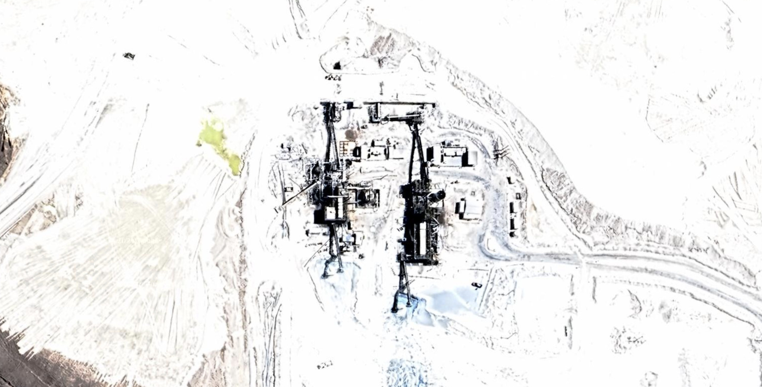
Figure 3: Infrastructural zoom of lithium evaporation ponds in the Salar de Atacama. Coordinates: 23°33'13.23"S, 68°24'19.75"W. Camera altitude above sea level: 2,747 m (Google Earth 2026).
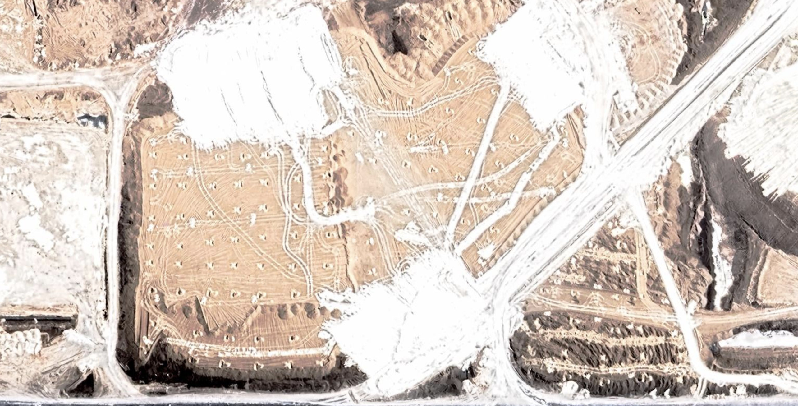
Figure 4: Infrastructural zoom of lithium evaporation ponds in the Salar de Atacama. Coordinates: 23°33'16.17"S 68°24'33.34"W. Camera altitude above sea level: 2,747 m (Google Earth 2026).
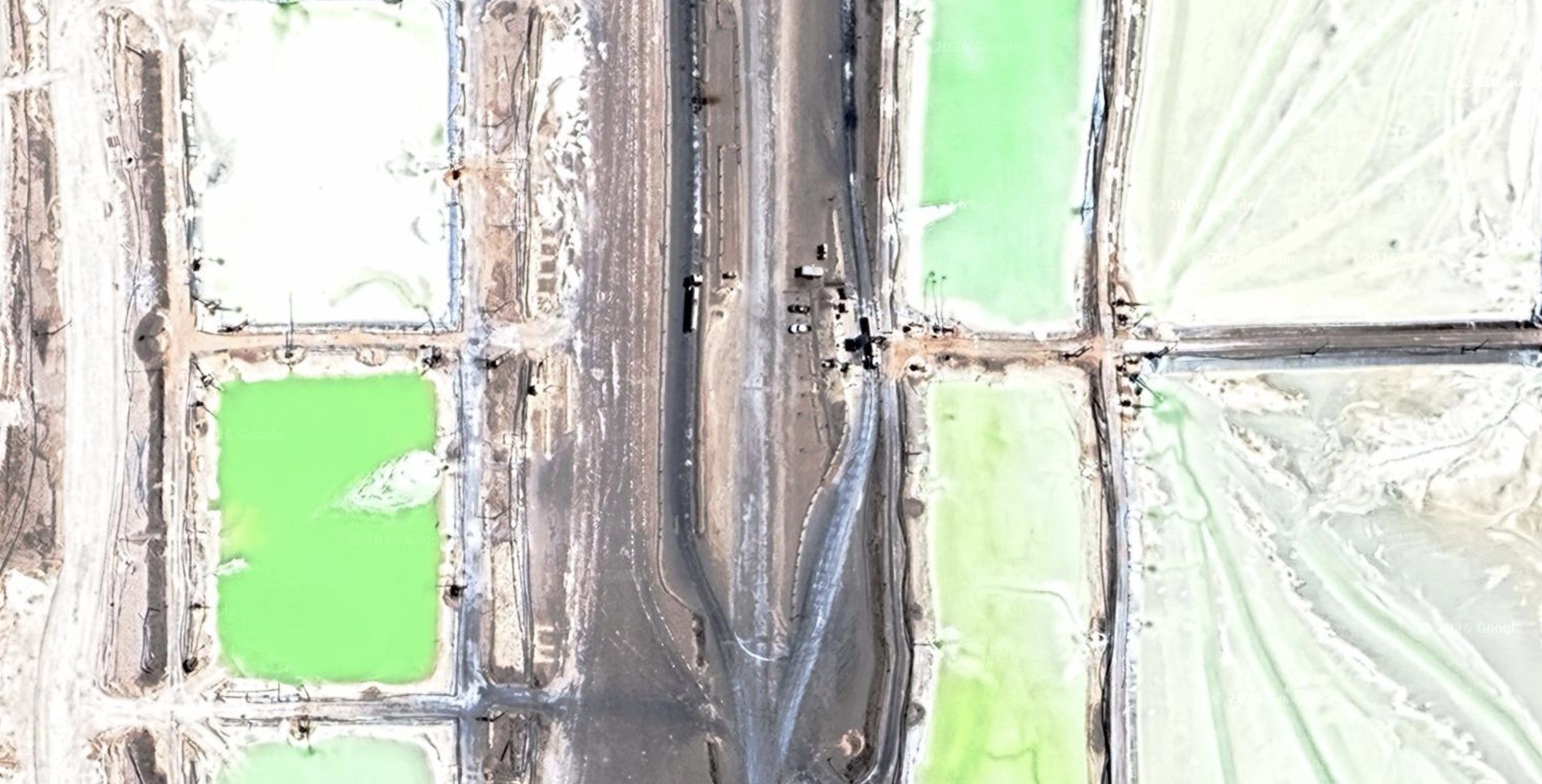
Figure 5: Infrastructural zoom of lithium evaporation ponds in the Salar de Atacama. Coordinates: 23°33'30.54"S 68°25'25.14"W. Camera altitude above sea level: 2,747 m (Google Earth 2026).
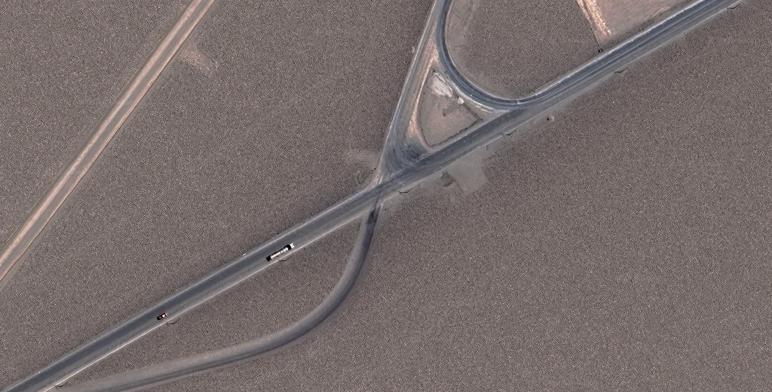
Figure 6: Infrastructural zoom of lithium evaporation ponds in the Salar de Atacama. Coordinates: 23°34'36.68"S 68°25'45.11"W. Camera altitude above sea level: 2,747 m (Google Earth 2026).
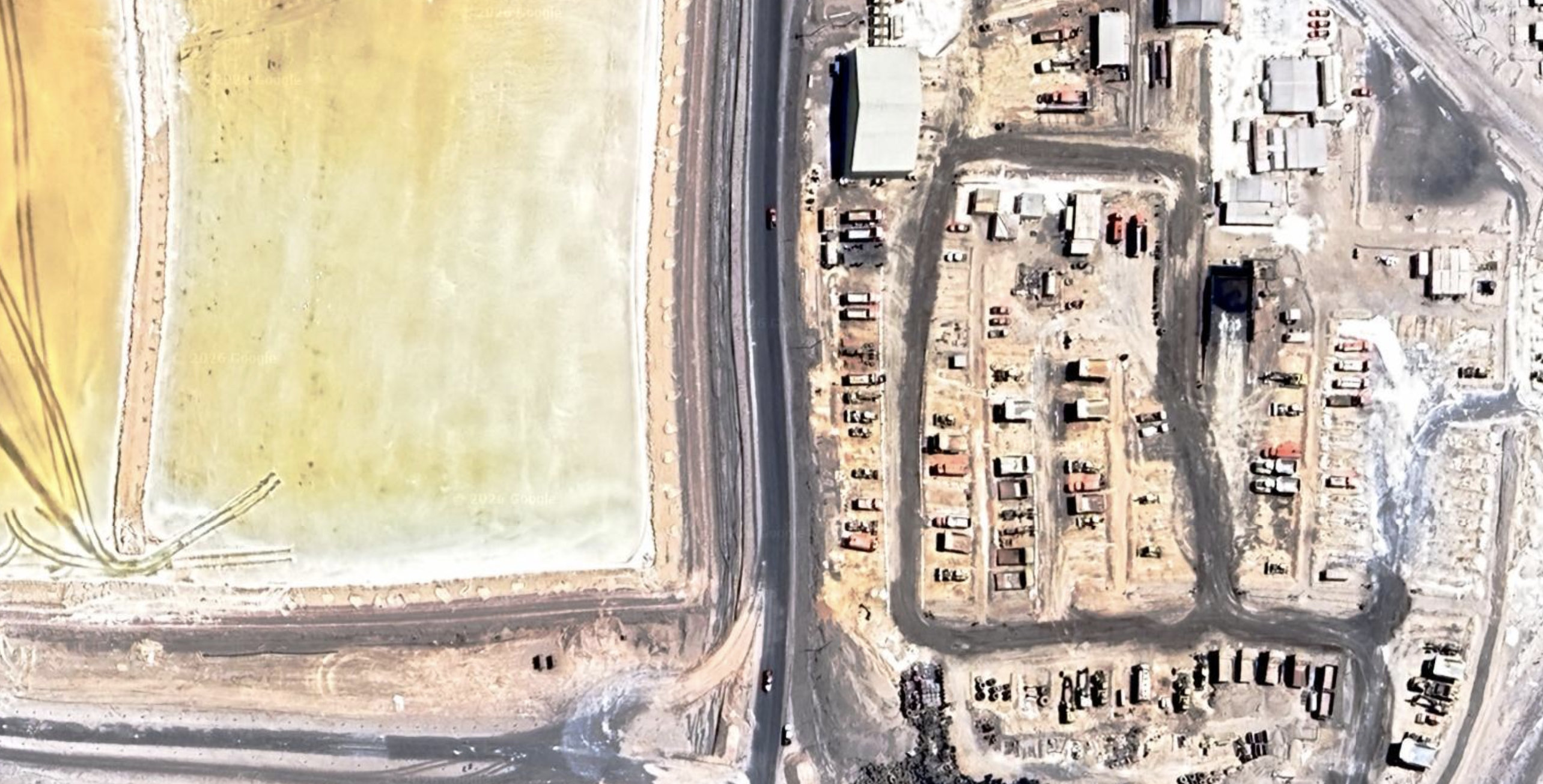
Figure 7: Infrastructural zoom of lithium evaporation ponds in the Salar de Atacama. Coordinates: 23°34'02.57"S 68°23'39.00"W. Camera altitude above sea level: 2,747 m (Google Earth 2026).
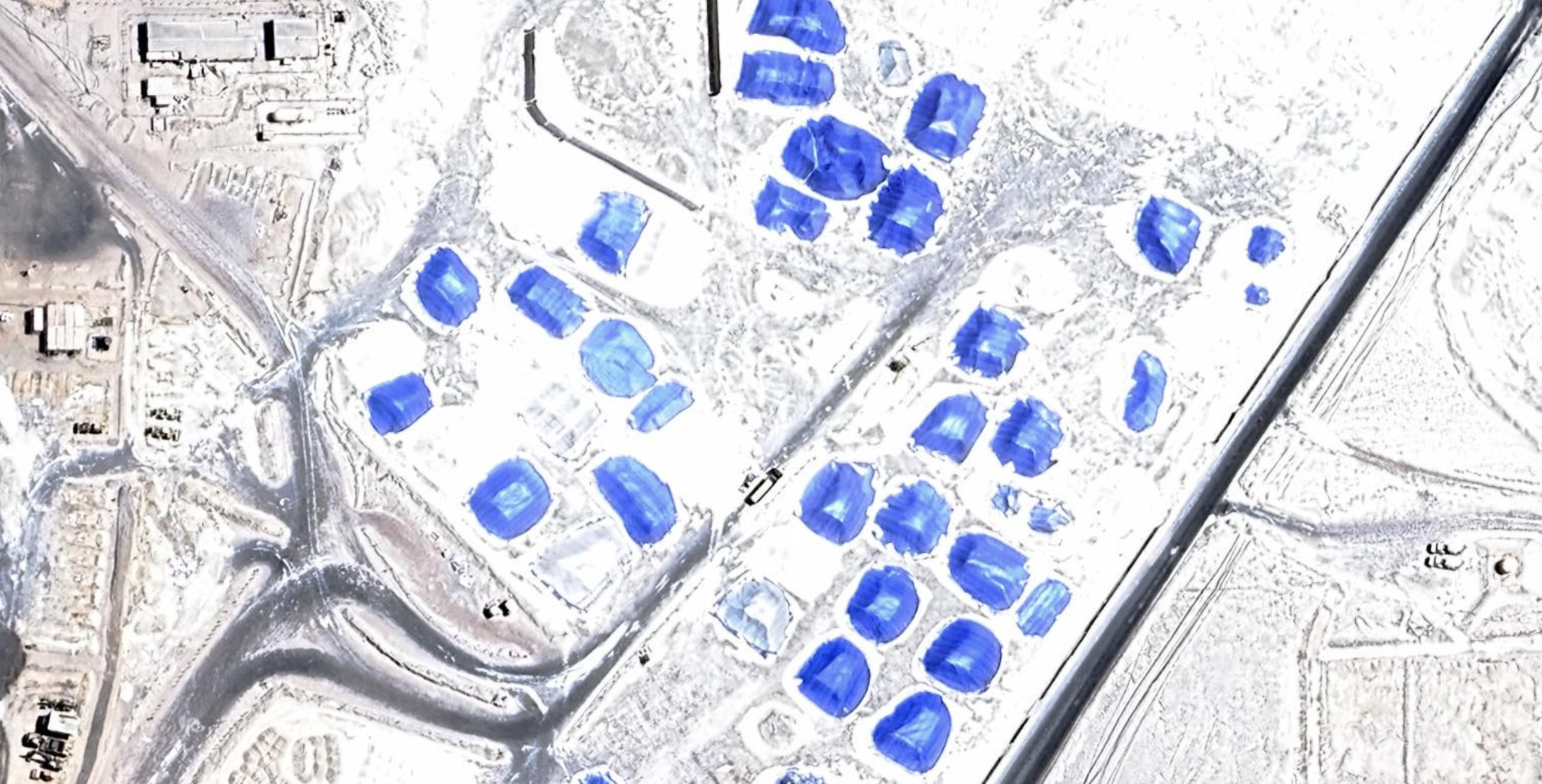
Figure 8: Infrastructural zoom of lithium evaporation ponds in the Salar de Atacama. Coordinates: 23°34'02.08"S 68°23'25.72"W. Camera altitude above sea level: 2,747 m (Google Earth 2026).
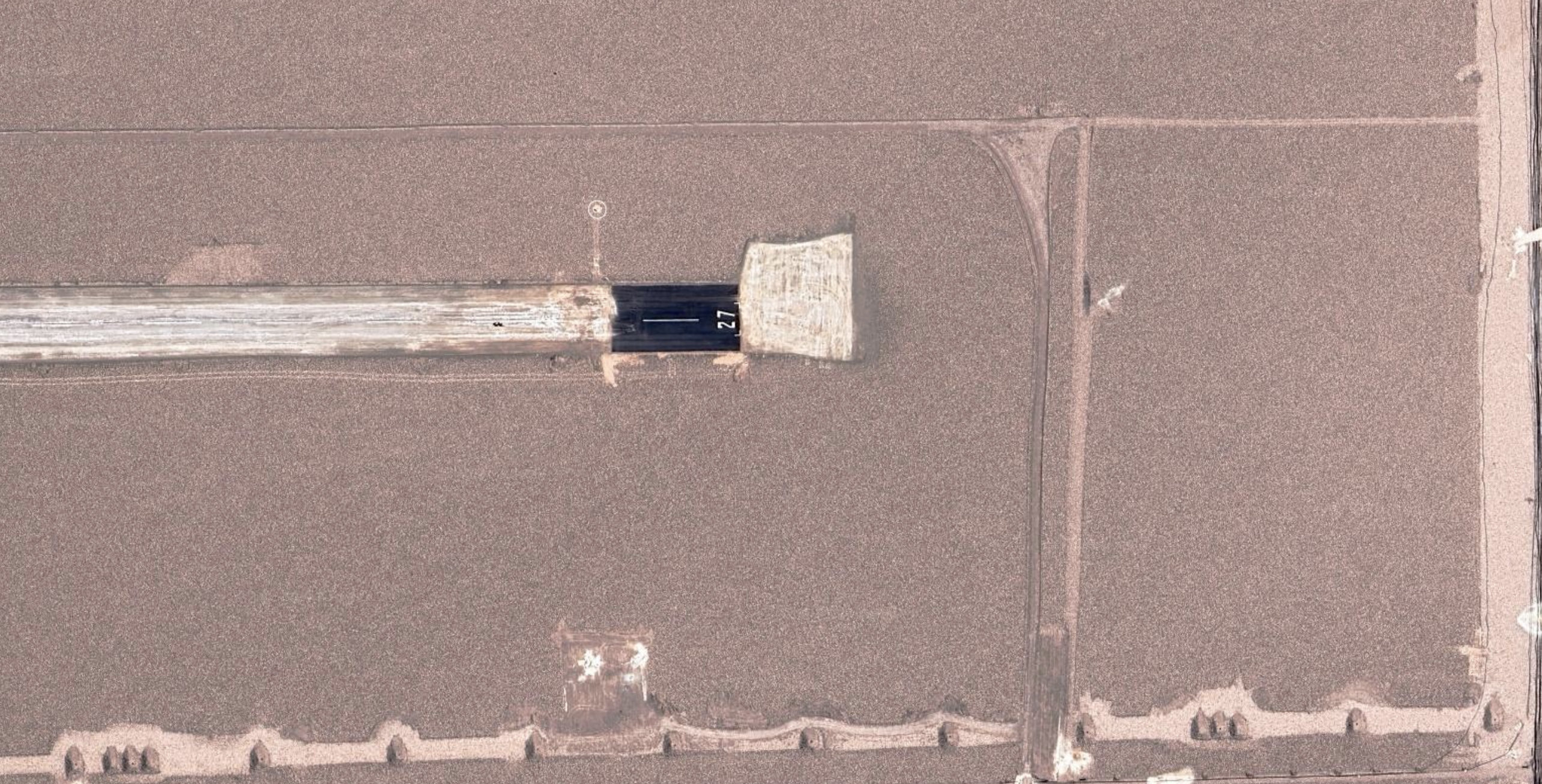
Figure 9: Infrastructural zoom of lithium evaporation ponds in the Salar de Atacama. Coordinates: 23°35'05.40"S 68°22'07.60"W. Camera altitude above sea level: 3,191 m (Google Earth 2026).
Participating through translation
“our words will not be heard / nor welcomed” (Lorde 1978)
If evaporation ponds aestheticise extraction as a controlled and intelligible landscape, the documentation of Indigenous consultation—and the files that contain it—demonstrate how extraction is governed through bureaucratic regimes of representation. Yet these same documents also expose the limits of that legibility: they register zones of impact, extend fields of influence and trace the uneven distribution of harm, making visible the differential exposure to adverse effects that the visual field of extraction works to obscure. Within Chile’s Environmental Impact Assessment System, Indigenous consultation is a state-led procedure established under ILO Convention No. 169. It is required when an environmental decision may directly affect Indigenous peoples and is intended to ensure consultation in good faith through their representative institutions (SEA 2025). In the Salar de Atacama, these processes primarily involve Lickanantay or Atacameño communities, whose territories extend across the basin and the settlements of Atacama La Grande. These communities are locally organised political and territorial entities, several of which are articulated through the Consejo de Pueblos Atacameños (Aylwin, Didier and Mora 2021, pp. 3–4). For Lickanantay communities, the conflict is also structured through claims to prior consultation, self-determination, territorial continuity and water (Aylwin, Didier and Mora 2021, pp. 14–20), while these disputes are folded into green-development narratives that subordinate Indigenous rights and socio-environmental protection to extraction (Godoy 2022, 97–98).
This becomes especially clear in the case of the Lickanantay communities of Atacama La Grande, whose territorial life has long been organised across the puna, prepuna, oases, vegas and pastoral fields, where water sustains ritual, agricultural and communal continuity beyond its treatment as a resource (Aylwin, Didier and Mora 2021). In this context, the Consejo de Pueblos Atacameños (CPA) has operated as a key political and territorial interlocutor. Through participation, these communities defend a historically constituted territorial relation that exceeds the project file.
For this reason, consultation takes place within an institutional grammar that already defines how concerns must be formulated, what kinds of evidence can circulate effectively, and which forms of argument acquire force within the assessment file (Babidge 2019, 51-21). Lickanantay claims do enter the process, but they do so under conditions in which rights claims concerning prior consultation, self-determination, land, territorial occupation and water must be translated into a technical-administrative language capable of being recognised by the Environmental Assessment Service (SEA), sectoral agencies and the project proponent (Aylwin, Didier and Mora 2021, pp. 14-20). Participation is therefore mediated from the outset by a demand for legibility.
This demand becomes clearer when one distinguishes between temporalities that overlap but do not align: the institutional time of the file, structured by resolutions, annexes, deadlines and procedural milestones; the corporate time of permitting, extraction schedules and mitigation commitments; the community time of deliberation; and the ecological time of the salar, where hydrological disturbance, brine extraction, microbial change and damage to vegas and bofedales unfold slowly and unevenly. This is what Sally Babidge describes as consultation’s ‘overburden’: the administrative, temporal, technical and political labour imposed on Indigenous communities (Babidge 2019, pp. 60-61). The problem of temporality therefore acquires a deeper dimension when administrative time governs participation, forcing communities to adjust their deliberation to the pace of evaluation, even as damage unfolds across much longer ecological and social durations.
Under these conditions, participation increasingly requires translation, as concerns grounded in lived relations to water, land, ceremonial continuity and pastoral use must be reformulated as objections, submissions, annexes and evidence. More broadly, lithium mining in Chile reveals how Indigenous consultation and environmental protection are repeatedly subordinated to an economicist framework linked to green-development and electromobility agendas (Godoy 2022, pp. 97-98). Lickanantay communities must therefore defend their territorial worlds against both the immediate effects of extraction and the broader discourse that frames lithium expansion as necessary, sustainable and globally beneficial.
Participation in the Salar de Atacama is a contested field in which multiple scales of power converge: community and pastoral occupation, the hydrological basin, regional and national development policy, and global demand for lithium. Within this field, Atacameño peoples use negotiated agreements as part of broader strategies to protect territory and water, secure a share of mining benefits, articulate territorial and environmental claims, and demand that the state fulfil its responsibilities toward Indigenous peoples (O’Faircheallaigh and Babidge 2023, pp. 641–644). Their mobilisation operates through and against the available institutional framework: agreements, legal claims, environmental objections, evidentiary records and the political role of the Consejo de Pueblos Atacameños become means of contesting the fragmentation of the salar into isolated projects and bounded impacts.
What emerges here is how the procedure itself reorganises what can count as territory, harm, and knowledge. Participation becomes the site where territorial continuity is broken down into demonstrable affectation, hydrological interdependence is reformulated as project-specific impact, and communal relations to the salar become admissible only when translated into the file's categories. The question, then, is who participates and under what epistemic conditions participation becomes possible at all.
Epistemic violence and procedural colonialism
“In a dark time, the eye begins to see” (Roethke 1961)
The conflict surrounding lithium extraction in the Salar de Atacama is environmental, legal and procedural in a specifically epistemic sense. As previous research has shown, consultation can produce a displacement of Indigenous peoples’ substantive rights into procedural debates over admissibility, impact, participation and assessment criteria (Carmona Caldera 2020, pp. 201-203). In the consultation file of the Environmental Impact Assessment (EIA) Plan de Reducción de Extracciones en el Salar de Atacama2, this displacement becomes visible as a sequence of administrative acts that progressively defines who qualifies as a directly affected Indigenous group and under what evidentiary standard. Thus, the file shows how ecological degradation, colonial inequality and exclusion from decision-making become intertwined within the same extractive regime (Braucher and Bianchi Benguria 2025, pp. 2-3). The project sheet in the Environmental Impact Assessment System (SEIA) records an initial opening of consultation with the Atacameño Indigenous Community of Camar in June 2022, an expansion in December 2023 to include the communities of Talabre, Socaire, Peine and Toconao, a 2025 request by the Comunidad Atacameña de Solor, a site visit and complementary submissions, a September 2025 resolution opening consultation with Solor, and later requests by Cucuter and by the Consejo de Pueblos Atacameños (CPA) and communities of San Pedro de Atacama, both answered in February 2026. Taken as a sequence, the file establishes the procedural grammar through which participation becomes possible, expandable or deniable.
A decisive threshold in this sequence is the impact identified by the Environmental Assessment Service (SEA) and the proponent in relation to ancestral occupation territories. The resolution opening consultation with Solor states that, in the Adenda and Adenda Complementaria, the proponent maintained the significance of impact ID 30: “susceptibility of affectation of the environmental value of the ancestral occupation territory of the Indigenous Communities of Toconao, Camar, Talabre, Peine and Socaire due to transport, transfer, displacement and maintenance and/or enabling of roads”. Procedurally, the expansion of consultation follows the formal identification of a significant impact associated with roads, transport and ancestral occupation within the logic of the file.
Solor’s request intervenes precisely at that point. In May 2025, the community invoked resuelvo 3 of Resolution No. 202302101816, which allowed consultation to be expanded if new impacts directly affecting other Indigenous groups were verified during assessment. Solor argued that the community was susceptible to direct adverse effects in relation to the Campos de Pastoreo de Solor, Vega de Cejar, Laguna Piedra and an aquifer protecting vegas and bofedales, and framed the issue at the basin scale by insisting on the hydrological interdependence of the Salar de Atacama watershed. The SEA’s September 2025 resolution re-specified that broader argument through verifiable occupation, project roads and effective communal use. On the basis of the July 2025 site visit and complementary information, it recognised effective occupation and free concession over the pastoral fields, found the conditions of Article 6(1)(a) of International Labour Organization Convention 169 and Article 85 of the Regulation of the Environmental Impact Assessment System (RSEIA) to be met, and opened an Indigenous Consultation Process (PCPI) with Solor.
Within this procedural asymmetry, communities confront the administrative order from outside, but they also act within it, mobilising resolutions, annexes, conciliation acts, free concessions and field evidence to defend water, territory and collective futures. In that sense, negotiated and procedural mechanisms can also become part of broader Indigenous strategies for defending territorial continuity under unequal conditions (O’Faircheallaigh and Babidge 2023).
The subsequent requests by Cucuter and by the CPA sharpen the dispute. Cucuter argued that the EIA reproduced a historical error by relying on older National Corporation for Indigenous Development (CONADI) records assigning the community only 4.21 hectares, whereas its actual occupation extends to 9,122 hectares, as reflected in a 2020 territorial conciliation act with Solor. As argued in the letter submitted to the SEA on 30 November 2025 by the Consejo de Pueblos Atacameños and a group of Lickanantay communities from San Pedro de Atacama, all Lickanantay communities in the Salar basin were susceptible to direct affectation, invoking both the hydrological “unity of the basin” and the ancestral character of Lickanantay territory. In both cases, the scale of the claim shifted from project-specific roads and bounded impacts toward a continuous, ancestral and hydrologically integrated basin (Consejo de Pueblos Atacameños et al. 2025).
The SEA’s February 2026 responses rejected that shift in explicitly technical terms. In the Cucuter response, the SEA stated that the determination of SAD (susceptibilidad de afectación directa, or susceptibility to direct adverse effects) depends on a causal linkage between: (i) part, work, or action of the project; (ii) area of influence; (iii) impact or effect; and (iv) direct affectation. Even territorial antecedents such as the 2020 conciliation act or the 2024 CONADI update, it argued, do not automatically trigger consultation. In that letter, the SEA emphasised that “consultation is not a mechanism of ‘recognition’ but of ‘specific participation in the face of direct affectation’”, and the file must remain congruent with the project, its area of influence and the impacts formally assessed (SEA Antofagasta 2026, p. 7). The response to the CPA applied the same logic: neither “cultural continuum” nor “basin vision” was accepted as a sufficient delimiter of territorial use for PCPI purposes. What counted were sites of current and permanent cultural manifestation, effective free concession and overlap with the roads and tracks associated with the recognised impact.
The aspects that emerge from this file is therefore a highly specific form of epistemic reduction. The SEA reclassifies broader Indigenous territorialities, hydrological interdependence and ancestral continuity as insufficient unless they can be translated into the regulated sequence required by the PCPI test: project work or action, area of influence, impact and direct affectation. At the same time, the sequence struggles to register territorial continuity and the ecological relations sustained by the salar itself. The violence of extraction unfolds across roads, plots and concessions and extends into deep-time microbial ecologies, hydrological balances and forms of interdependence that resist reduction to the thresholds and categories of administrative evaluation. (Bonelli and Dorador 2021). In this sense, the dispute concerns whether consultation occurs, as well as the scale and evidentiary form through which territory becomes admissible. Solor enters the process when effective occupation, concession and overlap with internal project roads can be demonstrated in relation to the impact already formalised in the file. Cucuter and the CPA, by contrast, seek to widen the frame toward territorial continuity, hydrological unity and the ancestral condition of the basin, but encounter a procedural order that fragments those claims into admissible and inadmissible components.
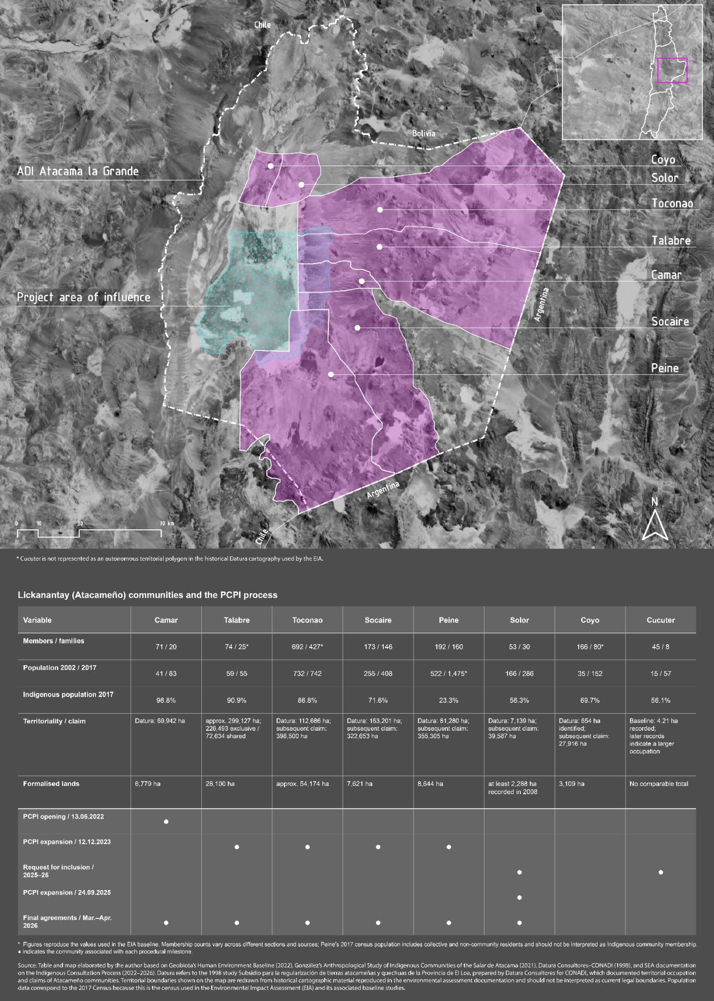
Figure 10: Table and map elaborated by the author based on Geobiota’s Human Environment Baseline (2022), González’s Anthropological Study of Indigenous Communities of the Salar de Atacama (2021), Datura Consultores–CONADI (1998), and SEA documentation on the Indigenous Consultation Process (2022–2026). Datura refers to the 1998 study Subsidio para la regularización de tierras atacameñas y quechuas de la Provincia de El Loa, prepared by Datura Consultores for CONADI, which documented territorial occupation and claims of Atacameño communities. Territorial boundaries shown on the map are redrawn from historical cartographic material reproduced in the environmental assessment documentation and should not be interpreted as current legal boundaries. Population data correspond to the 2017 Census because this is the census used in the Environmental Impact Assessment (EIA) and its associated baseline studies.
What comes after
What remains difficult to grasp is both the scale of extraction and the speed with which its landscape becomes ordinary. The evaporation ponds, the access roads, the monitoring wells, the maps, the resolutions, the consultation file itself: all of these begin as interventions and end up settling into the visual and administrative background of the Salar de Atacama. What first appears as an exception gradually starts to look normal. The transformed landscape slowly becomes the new condition of the desert. This may be one of the most consequential effects of the present moment. Questions of how much can be extracted and under what regulatory conditions are joined by two more fundamental questions: what kinds of futures remain available to Indigenous communities once their territories are treated as indispensable to the energy transition and to digital continuity? And what happens when that indispensability becomes administered as common sense?
For Lickanantay communities, the issue cannot be reduced to compensation, consultation periods or a better distribution of benefits. The deeper uncertainty lies in whether a community can continue to inhabit the Salar as a lived territorial relation once the basin is increasingly parsed into roads, sectors, impacts, concessions and areas of influence. The case of Solor and the rejected requests by Cucuter and the CPA suggest that the dispute concerns participation, the scale at which territory is recognised, and the conditions under which a hydrological and ancestral continuum is fragmented into administratively admissible units.
This is where the infrastructural landscape becomes politically decisive. Once extraction is made to look stable, procedural and technically bounded, it becomes easier to forget that it is still reorganising the terms of life in the basin. The ponds remain vivid from above. The roads remain available and active for management. The file remains seemingly legible. Is depletion being normalised alongside a way of seeing the Salar in which disruption becomes routine, obscured by the language and documents that are meant to safeguard it?
From the Salar de Atacama, unlearning intelligence means questioning the visual and administrative forms that allow extraction to appear coherent, necessary and governable. The question, then, is whether the interdependent worlds condensed in the Salar de Atacama can continue to exist without being reduced to infrastructure, variable or evidence. And if they cannot, what kind of future is being built there in the name of intelligence, transition and necessity?