


Part I – Introduction: The Cloud Has a Ground
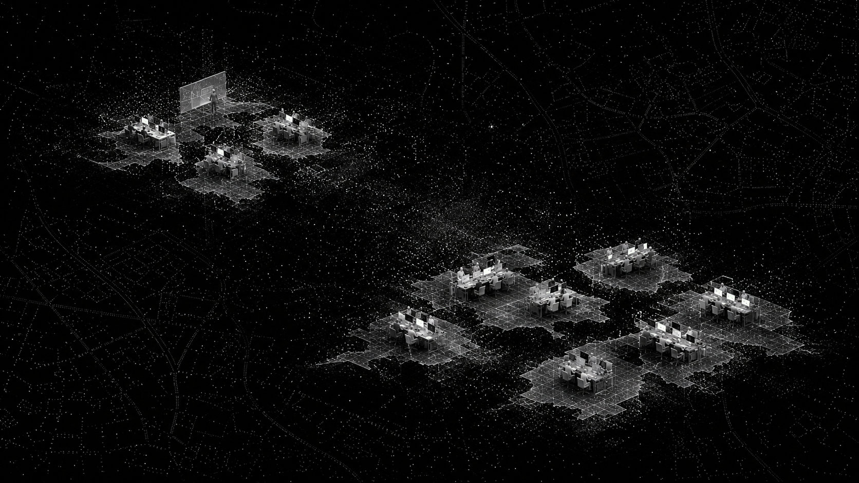
In Nairobi, AI labour extends beyond the conventional building into a dispersed arrangement of offices, interfaces, contracts and worker testimony. Annotators classify text and images according to client categories; content moderators review material through platform-specific systems. Both activities support AI training and platform safety, yet their contribution is absorbed into the language of automation. Figure 1 renders this spatial contradiction. Desks, screens, and instruction appear as fragments within a field that refuses the certainty of a verified floor plan. The drawing does not reconstruct a workplace; instead, it shows how judgement can be materially organised while its interior remains institutionally obscured.
The public record offers employment agreements, work permits, task queues, quality scores, audits, and litigation rather than an architectural survey. The term ‘ghost work’ names the distributed human activity concealed by automated services, while Fairwork’s investigation of Sama locates that abstraction in pay, conditions, contracts, management, and worker representation (Gray and Suri 2019; Fairwork 2023, pp. 2–3, 7–10). Vendor chains allow the resulting systems to appear autonomous by dispersing the decisions that sustain them across organisations and jurisdictions.
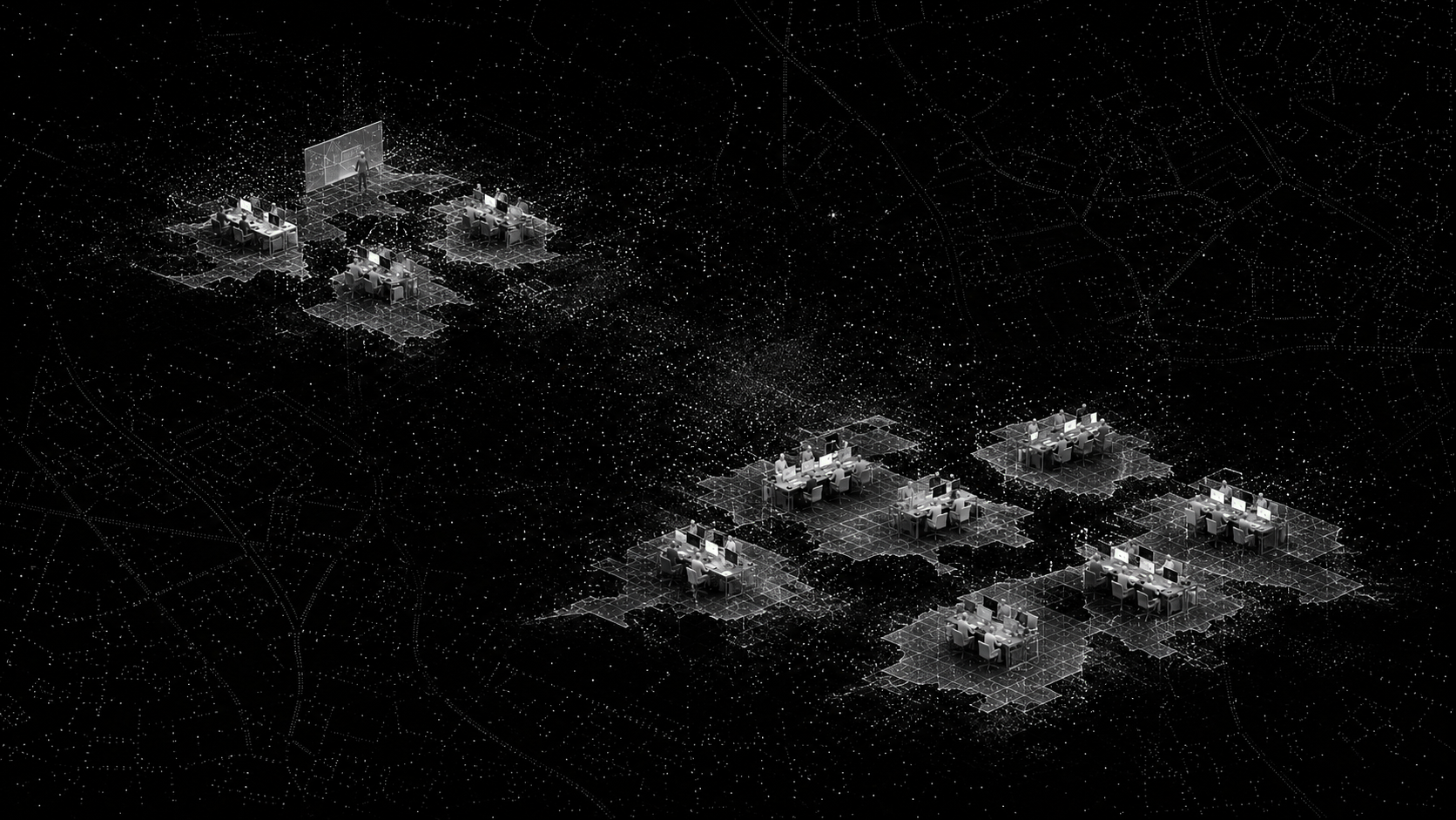
Figure 1: Distributed judgement: A speculative spatialisation of AI labour. Shared desks, screens, instruction, and grouped work are source-informed indications; dimensions, adjacencies, exact location and floor plan remain deliberately unresolved (Kipani 2026).
The second ground is more readily visible from above. In satellite images of Chile’s Salar de Atacama, evaporation ponds appear as rectangles cut into the desert. The image clarifies and, for that reason, deceives. It offers surfaces without aquifers, grids without governance, and ‘resource’ without history. Beneath and around this geometry lie brine deposits, freshwater systems, wetlands, lagoons, Lickanantay territories, mining contracts, and competing forms of environmental knowledge. Lithium production depends on managing variable brine, water, and climatic processes, while community-based research situates it within longer histories of water injustice and unequal green development (Bustos-Gallardo et al. 2021, pp. 177–181; Jerez et al. 2021, pp. 1–3). Figures 3 and 4 later set the visible field against the relations that the aerial view excludes.
The cloud keeps these grounds apart. Histories of cloud computing locate the term in network management, security, and political imagination, while critical accounts of AI and media geology assemble minerals, energy, data, labour, and earth materials into its technical field (Hu 2015; Crawford 2021; Parikka 2015). This literature establishes an essential premise: AI is material. Building from this, this paper asks how its grounds are separated from each other and from the places where its products are consumed, governed, and celebrated.
I approach this separation architecturally. Architecture here names more than buildings. It includes the organisation of enclosures, thresholds, circulations, interfaces, and representational conventions. An outsourcing arrangement distributes offices, digital workspaces, managers, clients, and legal obligations; an extraction field distributes wells, ponds, roads, and monitoring points. Each also arranges recognition, bringing some relations into view as technical variables while positioning others beyond the operational frame.
Feminist counter-cartography is the essay’s response: a situated practice for tracing spatial, contractual, temporal, and evidentiary relations without claiming a complete view. It follows infrastructures, documents, and interfaces; distinguishes evidence from inference; and marks what cannot ethically or empirically be shown. My central claim is that Nairobi and Atacama are materially distinct but structurally connected grounds of AI. In each, architectures of partition translate complex relations into administrable outputs or impacts, distancing those who bear infrastructural costs from those who define how those costs count.
Part II – Theoretical Framing: Feminist Counter-Cartography
AI’s materiality is a starting point, not the conclusion. Mines, energy networks, data centres, communications systems, and workplaces establish its distributed dependencies (Hu 2015; Crawford 2021; Parikka 2015). Yet a planetary inventory can connect distant sites while leaving governance, difference, and political subjects unexplained; it can even repeat the extractive demand that territory and experience become fully legible to an outside observer.
The three lenses answer different parts of that problem. Media geology dislodges the digital from imagined immateriality; feminist political economy shows how nature and labour are devalued and made available to accumulation; transnational feminist critique limits comparison by refusing a universal subject detached from history and power (Parikka 2015; Mies 1986; Mohanty 2003, pp. 17–42). I do not combine these positions into a seamless theory. I hold material tracing, political economy, and situated comparison in tension, using each to address what the others might leave unseen.
Architecture gives this tension a representational form. Feminist histories of domestic and urban design show how spatial arrangements can naturalise labour’s separation and isolation, while architectural media – drawings, photographs and publications – shape boundaries of public and private visibility (Hayden 1981; Colomina 1994). This expanded field lets AI infrastructure be read both as an arrangement of bodies and resources, and as a regime deciding what becomes recognisable as part of the system.
These concepts cannot determine in advance what matters in Nairobi or Atacama. They function as questions to be tested and revised through situated evidence. In Nairobi, the court record and worker-centred research bring language, migration, task hierarchy, and contractual control to the foreground (Arendse 2023, paras. 3–15, 35–42; Muldoon et al. 2025, pp. 533–540). Indigenous water-justice research and the consultation archive establish hydrological relations and territorial authority as central to Atacama (Jerez et al. 2021, pp. 2–3, 6–9; CORFO 2025a). These sources do more than illustrate a framework built elsewhere. They delimit the comparison: they determine which relations can be connected, which must remain differentiated, and what the counter-map can responsibly claim.
The comparison therefore refuses two flattened figures: a generic ‘African worker’, and a singular ‘Indigenous community’. Annotation and moderation involve different tasks and contractual relations, while migrant workers encounter vulnerabilities that cannot be generalised to all workers. Communities and associations may negotiate, contest or refuse extraction. Rather than comparing identities or interchangeable injuries, I compare how authority and responsibility are organised across territorial, institutional and jurisdictional boundaries.
The connection lies in administrative translation. In Nairobi, judgement and labour time are divided into tasks, metrics and vendor outputs. In Atacama, hydrological and territorial relations become variables, thresholds, and manageable environmental impacts. These translations do not make labour and water equivalent. The distance created through outsourcing is economically productive in that it pushes the costs of sustaining labour outwards while allowing insecurity to be presented as entrepreneurial opportunity. Within East African ‘impact sourcing’, promises of income, skills and mobility can therefore coexist with low wages, strict performance discipline, and value captured elsewhere in the supply chain (Mies 1986; Irani 2019; Muldoon et al. 2025, pp. 529–531, 539–540). Automation, in this reading, is not the disappearance of dependency or work but their reorganisation into forms that are easier to measure, manage and displace.
Counter-cartography follows these translations without promising a complete corrective view. Mapping is treated as a generative selection rather than a neutral record; every view occupies a material and institutional position, while remote-sensing images emerge through selective sensing, numerical conversion, and platform infrastructures (Corner 1999, pp. 213–225; Haraway 1988, pp. 581–590; Önal 2020, pp. 31–38). Maps, baselines, surveys, satellite images, task metrics, and legal categories are therefore instruments of recognition. Each brings selected relations into focus and leaves others outside the frame. The objective is not a more authoritative view from above but instead an account of how labour and territory become measurable, and of what that measurement cannot contain.
The method moves through four related operations. It reads physical arrangements; follows contracts, court proceedings, concessions and assessments; examines task queues, legal records, models, and baselines as instruments that organise visibility; and compares the temporalities imposed on labour and territory. Human judgement and recovery exceed product cycles and throughput targets, just as hydrological and territorial processes exceed investment schedules. No single source can hold these relations together. A judgement identifies companies, contracts, and contested obligations without disclosing the full experience of a workplace. Satellite imagery registers the changing geometry of ponds, but cannot establish aquifer conditions or the meaning of territorial change. The evidence remains deliberately heterogeneous: Kenyan judgements, labour research, company statements, worker accounts, hydrogeological studies, Indigenous water-justice research, and consultation records retain their different purposes and institutional positions.
The gaps among those sources are methodologically significant. Naming a company or locating a contractual relation can clarify responsibility; identifying workers, confidential interiors or unsupported territorial boundaries can create vulnerability or false certainty. Care therefore becomes a calibration of visibility: enough detail to locate power, but not enough invention to make uncertainty look resolved. This principle structures the figures. Figures 1 and 2 place a deliberately unresolved interior beside verified urban labels and a documented Nairobi corridor. Figures 3 and 4 distinguish documented references, inferred relations, and speculative geometry in Atacama. The figures do not close their evidentiary gaps. They give those gaps visual form.
Part III – Two Grounds of AI Infrastructure
The two grounds are approached through the same questions: what is converted into an input, through which infrastructures, according to whose evidence and temporalities, and where does responsibility settle? Beginning in Nairobi and moving to Atacama, the discussion follows human judgement concealed by automation, the mineral ground that sustains computation.
Nairobi: Distributed Judgement
The first ground is Nairobi, where AI labour becomes visible through employment records, interfaces, and litigation rather than a conventional architectural plan. ‘AI labour’ is not one activity. In 2021–22, OpenAI contracted Sama to label harmful textual material for an AI safety system. Reporting for TIME, Billy Perrigo (2023) found Nairobi-based take-home pay to be approximately US$1.32–US$2 per hour, depending on role and performance. Sama disputed elements of that account. This project involved data labelling and quality analysis, not Facebook content moderation. A separate chain connected Meta to moderators employed by Sama and, after Sama’s planned withdrawal from moderation, to a proposed transfer of work to Majorel (Arendse 2023, paras. 3, 15). Preserving the differences among annotation, quality analysis, and moderation prevents ‘ghost work’ from becoming another flattening abstraction.
The court record gives this distributed architecture of control a spatial and technical anchor. Sama acknowledged that one applicant worked at its Mombasa Road office, and that moderation took place through Meta’s SRT platform. Sama maintained that its managers supervised workers and enforced quality standards; the applicants argued that Meta’s platform, policies, metrics, and ticketing systems structured the work (Arendse 2023, paras. 5, 15, 35–42). Control is thus neither wholly inside the office nor wholly on the client platform. It runs through an office, a technical interface, and a contractual boundary: the vendor manages employment, while the client’s systems and standards shape how labour is organised and evaluated.
OpenStreetMap contributors (2026) situate the Mombasa Road corridor relative to central Nairobi, the Industrial Area, South B, the airport route, and Nairobi National Park. The Motaung judgement (2023, para. 39) identifies Sama’s premises as Sameer Business Park along Mombasa Road. Figure 2 nevertheless marks only a broad corridor, not a building, entrance, or workplace point. Its rendered network is an interpretive reconstruction rather than a GIS export or verified site plan. This restraint is methodological: the drawing locates an institutional geography without turning an approximate public reference into false precision.
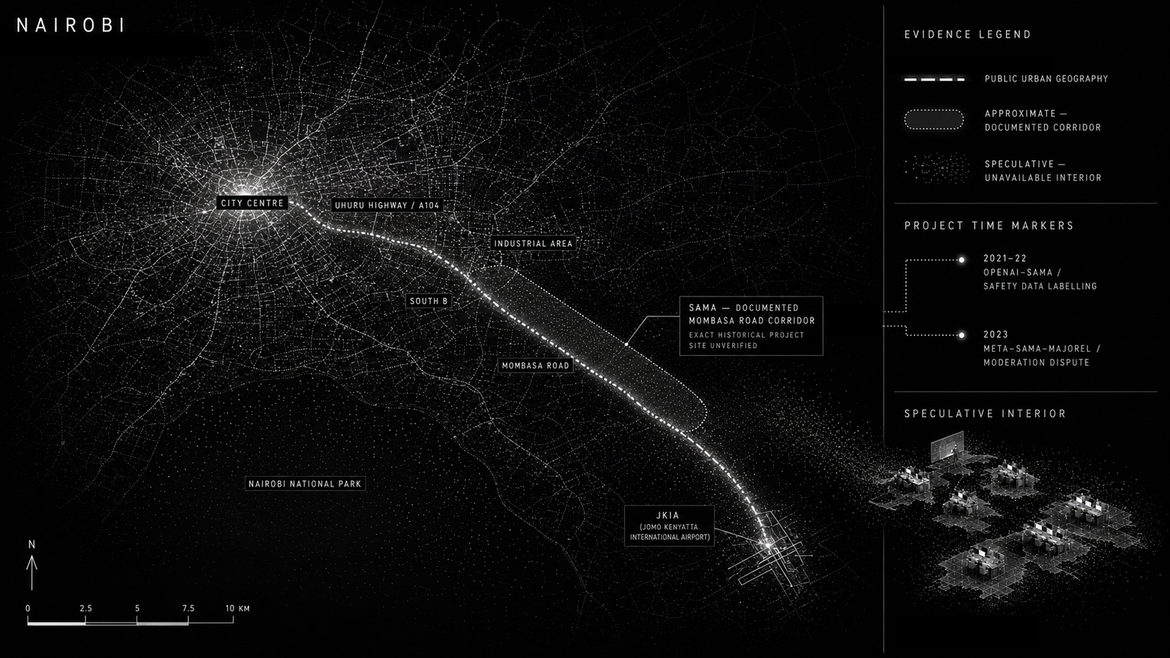
Figure 2: Locating AI labour: public geography, documented corridor, and speculative interior. Public urban geography is based on OpenStreetMap data (Kipani 2026).
The interface extends that geography. Task queues divide judgement into tickets, policy categories constrain decisions, and accuracy or handling-time metrics turn interpretation into measurable output. A client need not occupy the office to organise labour through software, standards and audits, even as legal employment obligations remain attached to another entity. The interface is architectural because it sequences material, judgement, time, and performance. It establishes the terms of compliant output. The comparison that follows concerns this administrative operation, not an equivalence between forms of harm.
No verified floor plan is available. Public evidence supports the existence of offices, training, platform-mediated tasks, and performance management, but not the spatial certainty of a conventional architectural drawing (Fairwork 2023, pp. 7–10; Arendse 2023, paras. 5, 15, 35–42; Muldoon et al. 2025, pp. 533–540; Perrigo 2023). Returning to Figure 1, the drawing makes that absence methodological. It assembles source-based indications of shared desks, screens, instruction, and collective work while withholding dimensions, adjacencies, and a precise location; its fragmentary geometry marks rather than fills the limit of public knowledge.
Read together, Figures 1 and 2 move between an unresolved interior and the public geography through which it can be cautiously located. Working conditions emerge through a distributed and contested archive. Applicants alleged exposure to disturbing material, demanding metrics, and inadequate support; Sama and Meta disputed important aspects of those claims. The ruling nevertheless treated the platform, its standards, and the contractual arrangement as relevant to responsibility (Arendse 2023, paras. 5, 15, 35–42). Fairwork’s five principles of pay, conditions, contracts, management, and representation, read alongside research on low wages, workplace discipline, and Sama’s ‘impact sourcing’ model, reveal a conflict over who gets to define fair work (Fairwork 2023, p. 7; Muldoon et al. 2025, pp. 529–531, 539–541). Workers, vendors, platforms, courts, and researchers occupy different positions; no single account exhausts the workplace.
Time is one of the system’s quietest instruments. Task queues, accuracy requirements, and delivery schedules place judgement inside rapid product cycles, deciding when work is complete and performance acceptable. Human judgement, recovery, and career development nevertheless exceed throughput targets. This temporal discipline provides a point of comparison with Atacama, where slower hydrological and territorial processes exceed investment schedules. The consequences are not equivalent, but both arrangements assign institutional authority over when evidence is sufficient and intervention reasonable.
Litigation has made parts of the outsourcing arrangement unusually visible. The 2023 Motaung ruling addressed whether foreign platform companies could remain parties to a Kenyan workplace claim, and allowed the petitioner an opportunity to complete service rather than striking them out (Motaung 2023, paras. 76–121). A related petition challenged redundancies and the proposed transfer of moderation from Sama to Majorel (Arendse 2023, paras. 1–15). In 2024, the Court of Appeal dismissed Meta’s jurisdictional challenges, allowing the claims to proceed in Kenya (Meta Platforms et al. v Motaung et al. 2024, paras. 1–2, 37–50, 66); an April 2026 ruling later permitted amendments and procedural consolidation (Motaung 2026). This procedural history draws the corporate architecture more clearly than an office plan could: it shows responsibility being negotiated across contractual and territorial boundaries.
Outsourcing separates operational control from formal employment without making them independent. Platform standards, interfaces, and performance systems shape moderation, while the vendor recruits workers, manages the workplace, and carries direct employment obligations. The proposed transfer to Majorel exposed the material stakes of that division. A vendor change could affect employment, immigration status, and access to remedy even as Meta’s demand for moderation remained; interim orders restricted the redundancies and transfer while the petition was pending (Arendse 2023, paras. 3, 15, 41–42). The vendor boundary does not remove responsibility. It redistributes it.
Nor is Nairobi a generic reservoir of inexpensive labour. Moderators were recruited across Kenya and other African countries for specific linguistic markets, and the court record identifies the consequences redundancy could carry for immigrant moderators’ status and repatriation (Arendse 2023, paras. 3, 15, 41–42). Language and migration are therefore material components of the labour system, not demographic context added after the fact.
Task hierarchy and aspiration also matter. Perrigo’s investigation (2023) distinguished labelling agents from quality analysts in the OpenAI-Sama project, with different reported responsibilities, pay levels and performance expectations. Worker research documents training and career support alongside limited advancement and value captured elsewhere in the supply chain (Muldoon et al. 2025, pp. 533–540). Former moderators also established organising initiatives, and contributed to wider advocacy for African AI workers, including the work of Mophat Okinyi documented by Perrigo (2024). They enter the counter-map not only through injury or precarity but as political actors who produce evidence, contest institutional accounts, and build solidarities.
The Nairobi figures draw this tension between specificity and restraint. They locate the city, corridor, institutions, categories of work, and contested forms of control, but do not invent a project address, floor plan or worker-identifying detail. Care does not require leaving the system invisible. It requires making responsibility legible without making uncertainty disappear.
Together, Figures 1 and 2 show how automated intelligence depends on partitioning human judgement across space and contract. The documented corridor locates institutional responsibility; the unresolved interior marks where public evidence ends. From this dispersed workplace architecture, the essay turns to Atacama’s extraction field.
Salar de Atacama: Extractive Territory
The second ground is the Salar de Atacama, which reads as a drawing before it reads as a place. Evaporation ponds divide the salt flat into geometric basins connected by wells, pipes, roads, and industrial infrastructure. Brine is pumped from subterranean deposits and concentrated through evaporation. This is an ‘eco-regulatory’ mode of production because profitability depends on managing variable hydrogeological and climatic processes (Bustos-Gallardo, Bridge and Prieto 2021, p. 177). The extraction field is also measured: monitoring points, baselines, and administrative boundaries determine where change becomes legible. Figures 3 and 4 stage this visible field, while marking the different evidentiary status of its territorial and operational layers.
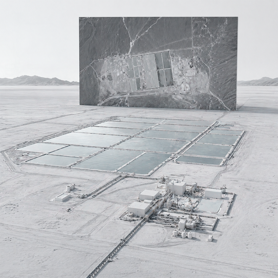
Figure 3: Interpretive reconstruction of lithium-extraction infrastructure in the Salar de Atacama. A satellite-derived plan is juxtaposed with a speculative three-dimensional field of evaporation ponds, circulation lines, and industrial equipment. Geometry is interpretive and not to scale (Kipani 2026).
For Lickanantay communities, however, the salar is not an isolated mineral deposit. It is lived territory, sustained through relations among aquifers, springs, wetlands, lagoons, grazing, agriculture, mobility, and political authority. Lithium extraction in this relational landscape is inseparable from water injustice within Indigenous Andean territory (Jerez et al. 2021, pp. 2–3, 6–9). The technical distinction between brine and freshwater remains indispensable to environmental regulation, yet it cannot settle the salar’s hydrological complexity. Three-dimensional modelling maps an irregular mixing zone where freshwater and brine meet at the salar’s margins (Marazuela et al. 2018, pp. 223–230), while isotope and hydroclimate analysis shows how relic groundwater and prolonged drought complicate short-term claims of causality (Moran et al. 2022, secs. 2.1, 4.1–4.2, 5.4). The dispute concerns more than withdrawal volumes. It concerns who may define water, establish evidence of depletion, and decide what threshold of change is acceptable.
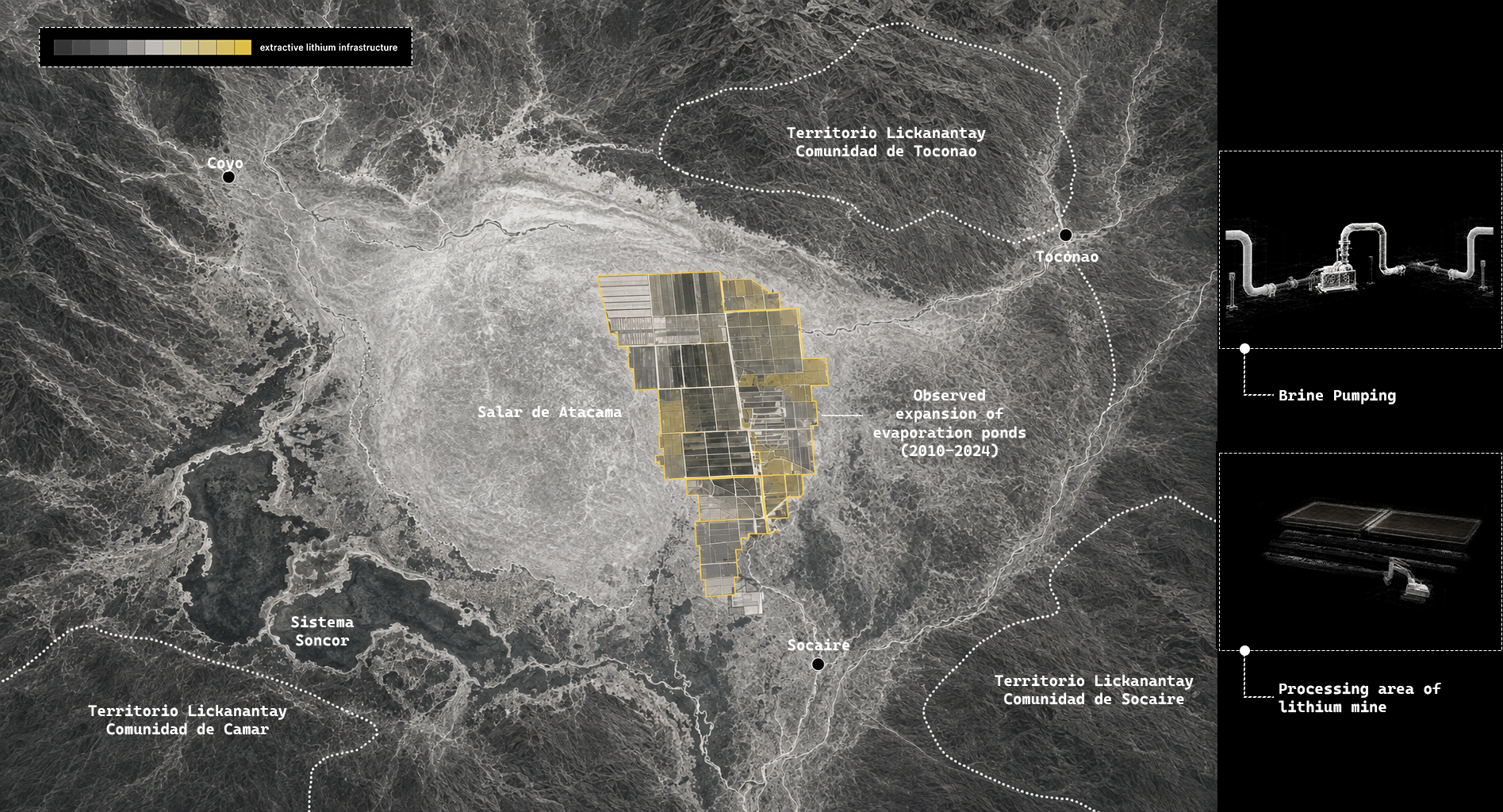
Figure 4: Salar de Atacama: extraction infrastructure, territorial relations and operational typologies. Named settlements derive from public geographic references; dotted territorial outlines are approximate interpretive traces rather than verified legal boundaries. The grey-to-yellow sequence, explicitly keyed from 2010 to 2024, is an author interpretation of dated satellite imagery (Kipani 2026).
Read together, Figures 3 and 4 make the surface extent of extraction legible while leaving subterranean conditions unresolved. The USGS Landsat sequence documents the changing geometry of evaporation ponds (USGS EROS Center n.d.), but it cannot independently establish aquifer conditions, ecological causality, or the territorial meaning of hydrological change. Subterranean processes become governable through environmental assessments, monitoring programmes, and simulations. The position of monitoring points, the choice of baseline periods, and the boundaries and thresholds built into models determine which changes become visible and actionable (Bustos-Gallardo et al. 2021, pp. 181–185). The counter-map therefore places the visible extraction field beside this less visible architecture of evidence. It asks how knowledge is produced and validated before it is translated into regulatory action.
This is not a simple opposition between scientific and Indigenous knowledge. The more consequential issue is the unequal distribution of evidentiary authority. Environmental governance separates water into measurable variables, modelled zones, and areas of influence; Lickanantay accounts situate it within ecosystems, livelihoods, cultural continuity, and territorial authority (Jerez et al. 2021, pp. 2–3, 8–9). Around the salar, territory, indigeneity, biodiversity, and benefit are themselves contested and co-produced (Lorca et al. 2022, pp. 1–3). Modelling is not itself the problem. The imbalance appears when its assumptions pass as neutral while other forms of knowledge must enter categories they did not design.
The phrase ‘Indigenous community’ can flatten the political field in a similar way. CORFO’s final resolution records fifty-one participating organisations – twenty-eight communities, and twenty-three associations – whose submissions contained proposals, agreements, and dissents (CORFO 2025b, para. 20). Relationships with mining companies may bring material benefits while generating tensions within and between communities over water, biodiversity, identity, and benefit-sharing (Lorca et al. 2022, pp. 1–2, 8–10). Negotiation, consent, opposition, and legal challenge can coexist. Consultation creates an archive in which different positions are recognised, reorganised, or contained.
The Chilean consultation process, conducted under the right to consultation in Convention No. 169, generated meetings, written submissions, minutes, and a final report (ILO 1989, art. 6; CORFO 2025a). These records matter because they preserve participation and disagreement, yet they can also translate territorial claims into evidence that a procedural requirement has been met. Consultation is both a rights mechanism and a representational technology: it provides a formal space for affected groups to speak, while determining how their claims are recorded and what institutional consequences may follow.
That tension became explicit in the 2025 consultation connected to the Codelco-SQM partnership. Reuters (2025) reported that the Coyo community and the Atacameño Association of Irrigators and Farmers of San Pedro de Atacama challenged the process, alleging insufficient information and time. CORFO recorded the final dialogue meeting on 8 August, and formally concluded the consultation on 30 September (CORFO 2025a, 2025b). The Antofagasta Court of Appeals rejected the resulting protection actions on 2 October; the Supreme Court confirmed that judgement on 30 December (Corte Suprema de Chile 2025). The rulings resolved the legal actions, not the political disagreement over information, procedure, and territorial authority. The same archive can preserve dissent and allow procedural completion to be presented as evidence that conflict has been addressed.
Decarbonisation intensifies these questions rather than settling them. Lithium demand is being driven by electric mobility, battery storage, and other energy technologies, while recycling and changes in battery chemistry can alter the scale and composition of future primary demand (International Energy Agency 2025, ‘Executive summary’ and ‘Overview of outlook for key minerals’). That global function does not determine how extraction should be scaled, how benefits should be distributed, or who may define cumulative limits. Codelco’s announcement of the NovaAndino Litio venture, formalised in December 2025 with activities extending to 2060, gives such decisions a long material horizon (Codelco 2025). The counter-map must resist two easy images of the salar: untouched nature and inevitable sacrifice zone. Its task is to locate where necessity is declared, how evidence is authorised, and whether affected communities retain an effective capacity to contest extraction. A project framed as a global environmental benefit can still reproduce local water injustice (Jerez et al. 2021, pp. 1–3, 8–9).
Across Figures 1–4, comparison begins with material difference. Judgement and labour time are organised through workplaces, interfaces, performance standards, contracts, and litigation. Brine, water relations, and territorial authority are organised through wells, ponds, monitoring points, models, and consultation procedures. One is a workplace and contractual arrangement; the other, a hydrological and territorial field. Preserving that difference is the condition of comparison.
What crosses the distance is a related institutional operation. AI appears autonomous after human judgement is translated into task metrics and vendor output; lithium enters circulation after territorial relations become environmental variables and compliance records. These separations move value while displacing costs, but situated comparison keeps each site’s histories and political subjects in view (Mies 1986; Mohanty 2003, pp. 17–42). Counter-cartography follows judgement into an accuracy score, employment into a vendor dispute, water into a modelled impact, and disagreement into a consultation record. It also stops where its evidence stops. The Nairobi drawings cannot expose workers or reconstruct an undocumented interior; the Atacama maps cannot make uncertain subterranean hydrology fully knowable. These limits allow the drawings to trace responsibility without reproducing the extractive visibility they contest.
Part IV – Conclusion: Redrawing Accountability
Nairobi and the Salar de Atacama show that AI is sustained by political architectures of evidence as well as by technical systems. In Kenya, annotation and moderation are organised through workplaces, interfaces, metrics, and contracts that distribute control between client and vendor. In Chile, extraction infrastructure reorganises a hydrologically complex Indigenous territory while models, monitoring systems, and consultation records authorise particular accounts of environmental change. The sites do not reveal a single hidden substrate of AI. They show how infrastructure creates distance: labour from technical output, extraction from consumption, and responsibility from control. The cloud depends on these partitions – labour in one place, land in another, intelligence apparently everywhere.
Feminist counter-cartography contributes more than another demonstration that AI is material. It offers an operational method for tracing how material conditions are separated, represented, and governed. Physical and institutional arrangements are read together; maps, models, interfaces, and legal records become instruments of recognition rather than neutral containers of fact; imposed temporalities become part of the analysis. In Nairobi, metropolitan geography is joined to contractual responsibility while the inaccessible workplace interior remains explicitly speculative. In Atacama, the visible geometry of ponds is set against uncertain hydrology and plural territorial claims. Partiality and refusal are not deficiencies awaiting a more comprehensive image. They are conditions of accurate and ethical representation.
This method also changes what is compared. Labour and water are not analogous substances, and workplace and territorial harms are not equivalent experiences. The connection lies in translating complex relations into evidence that can travel: judgement into performance data, employment into a vendor dispute, depletion into a modelled impact, and territorial claims into consultation records. Feminist political economy explains how separating and devaluing nature and labour supports unequal accumulation; situated comparison requires each ground’s histories and political subjects to remain present (Mies 1986; Mohanty 2003, pp. 17–42). Their conjunction does not resolve the sites into one story. It makes the work of connecting them more accountable.
Visibility alone, however, does not redistribute power. Maps can reproduce colonial demands for territorial legibility, just as accounts of precarious labour can turn testimony into spectacle. A counter-map must be specific enough to locate institutions, contracts, and mechanisms of control, yet restrained enough not to claim authority over territories, experiences, or spaces it cannot know. Its ethical task is not to reveal everything. It is to state what is documented, what can be inferred, and what must remain unresolved.
This limit returns the argument to a threshold: who has the authority to define it? In both grounds, participation often begins after the operational frame is established. Work will continue while performance and harm are measured; extraction will continue while its effects are monitored. Workers and communities may contribute evidence, but the categories through which that evidence becomes meaningful – and the decisions it may affect – are frequently already fixed. Greater visibility can therefore improve institutional knowledge without redistributing the power to decide what happens next.
Accountability would require more than adding testimony to an existing procedure. It would recognise the authority of workers and affected communities to shape the categories, temporalities, and limits through which labour and extraction are governed: what counts as harm, when evidence is sufficient, which obligations follow, and when an activity must be altered, suspended or refused. The political task of counter-cartography is not to complete the cloud’s incomplete map. It is to contest who may draw its boundaries, and to reopen the conditions under which its infrastructures are permitted to continue.